ADVENTURES
What a vacation this was. We seen more than I even though possible in a little over a one week period. Drove 2,200 miles and somehow managed not to kill each other.
In order - Our Stops
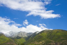
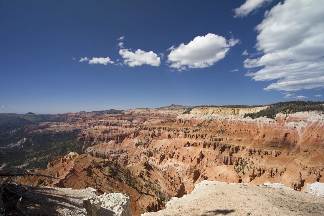
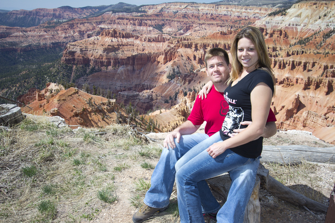
1. Cedar Breaks
2. Bryce Canyon
3. Zion
4. Glen Canyon
5. Antelope Canyon
6. Rainbow Bridge
7. Grand Canyon
8. Arches
9. Canyonlands
10. Timpangos Cave
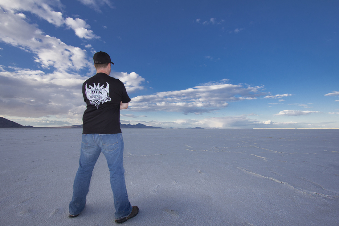
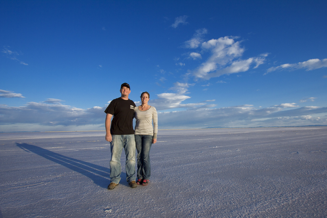
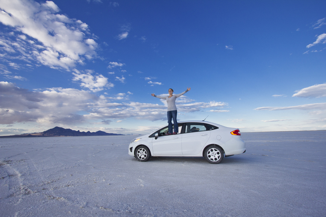
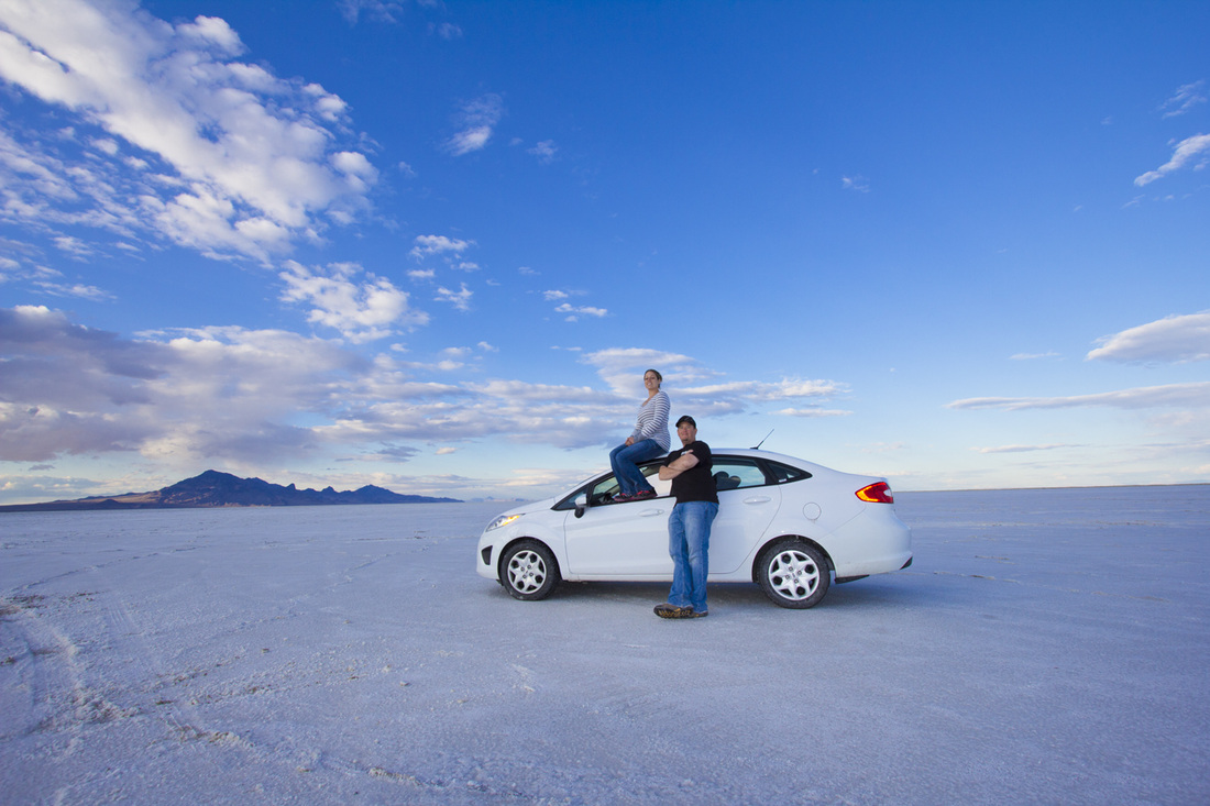
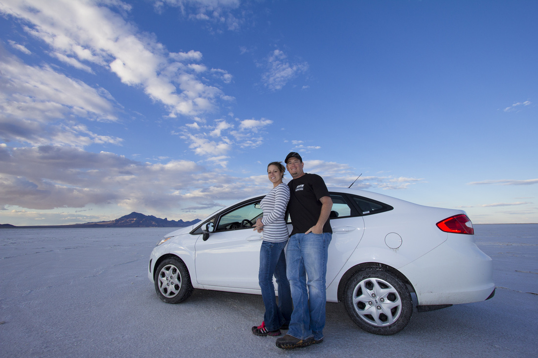
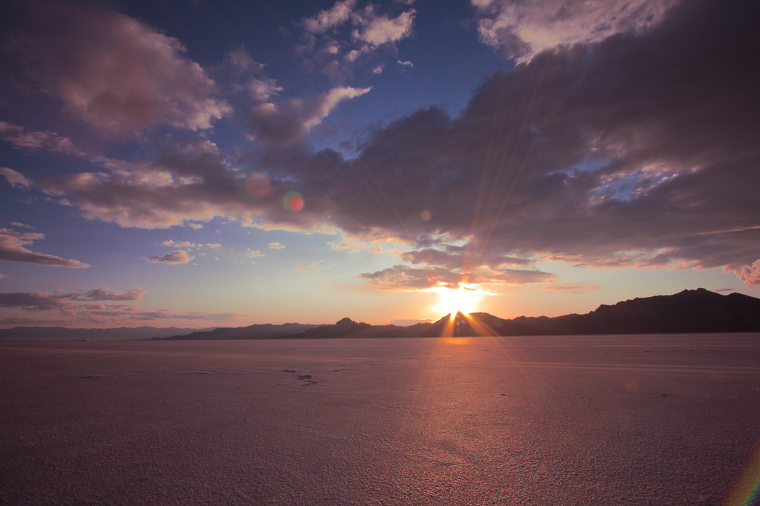
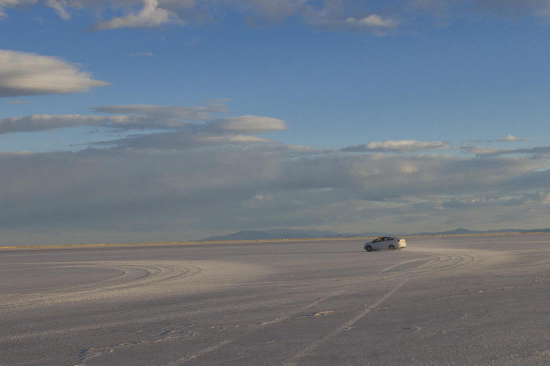
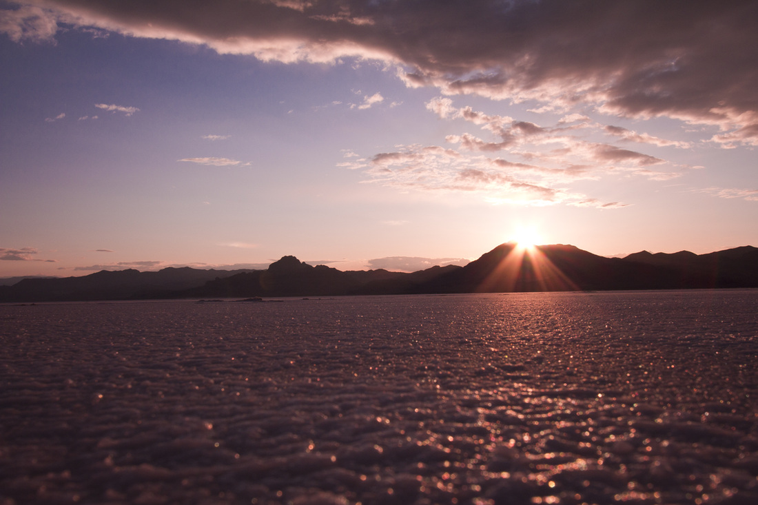
11. Salt Lake Flats
2. Bryce Canyon
3. Zion
4. Glen Canyon
5. Antelope Canyon
6. Rainbow Bridge
7. Grand Canyon
8. Arches
9. Canyonlands
10. Timpangos Cave
11. Salt Lake Flats
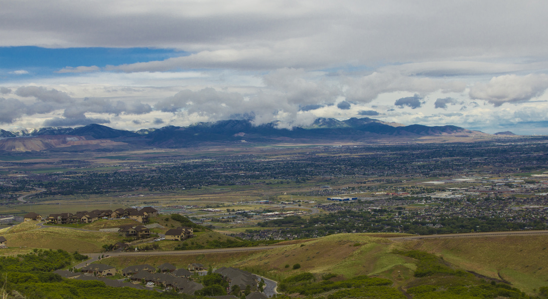
Saturday May 19th, afternoon we left the dog with the sitter, and was off. With the time difference and a slight flight delay, we landed in Salt Lake City, Utah around 10:30pm. (this is now 12:30am EST) Picked up the rental car and then headed to our friend Garrets place to stay the night. The condo traditionally used for snow skiing vacations was beautiful. Decorated perfectly and gave it a modern cabin feel.
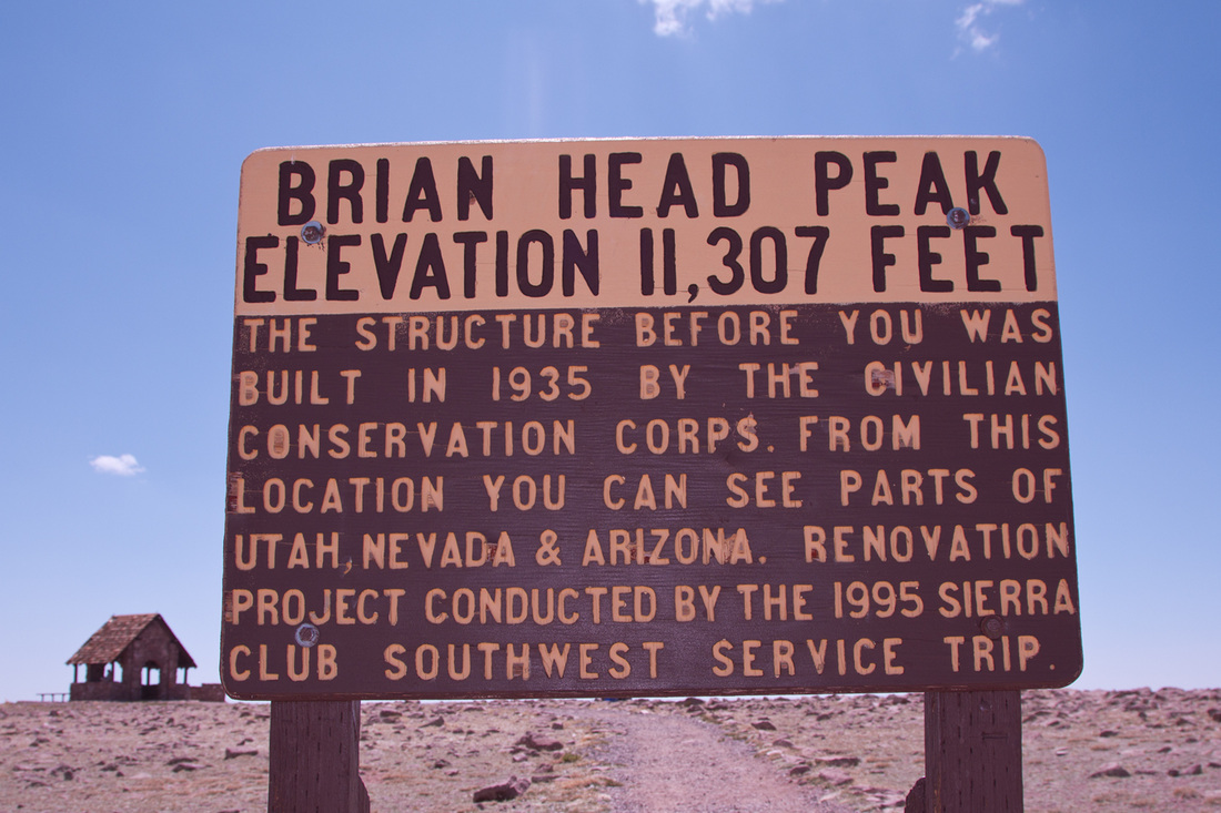
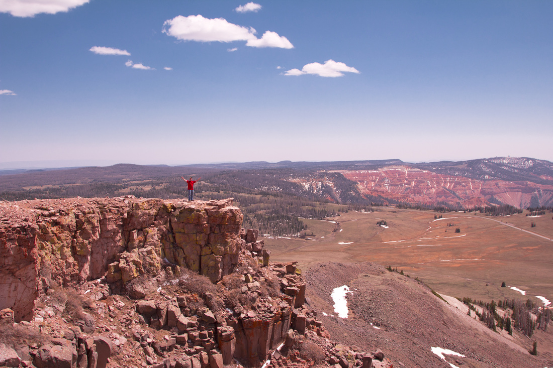
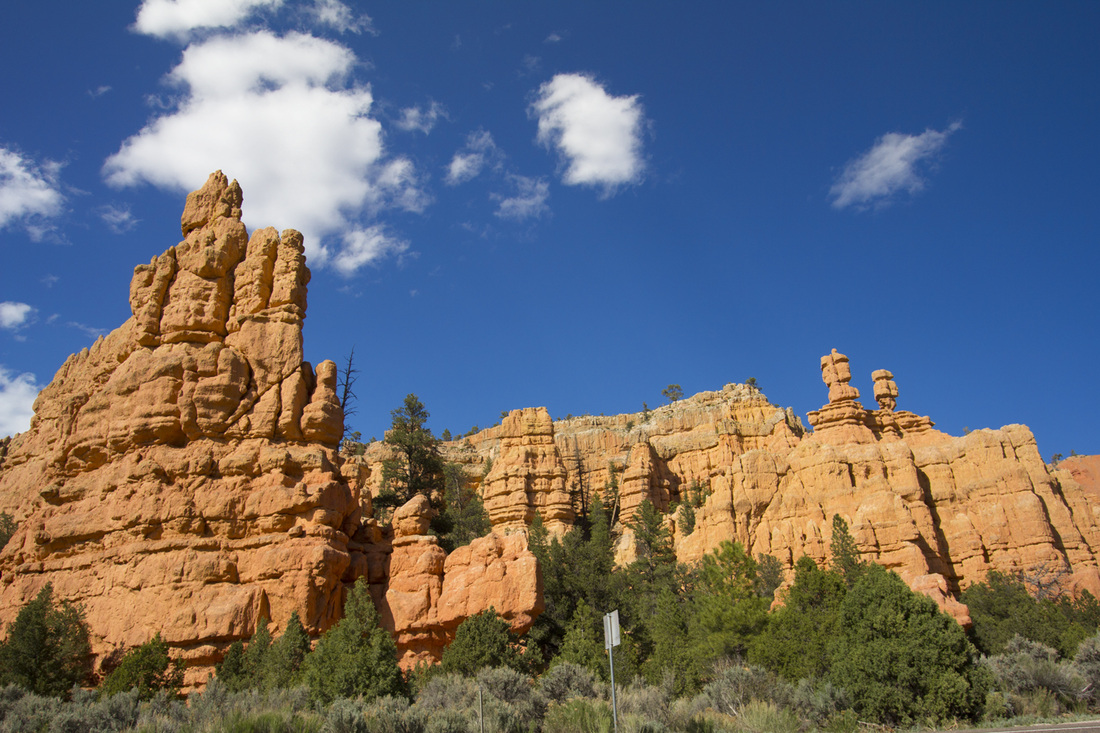
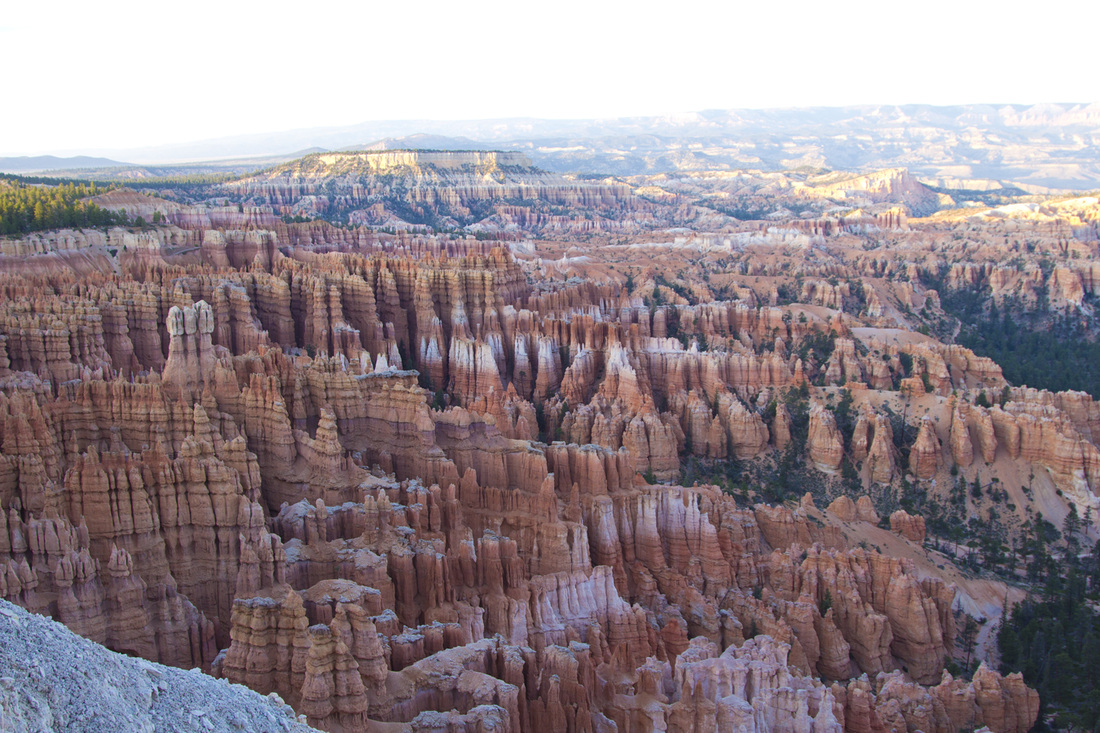
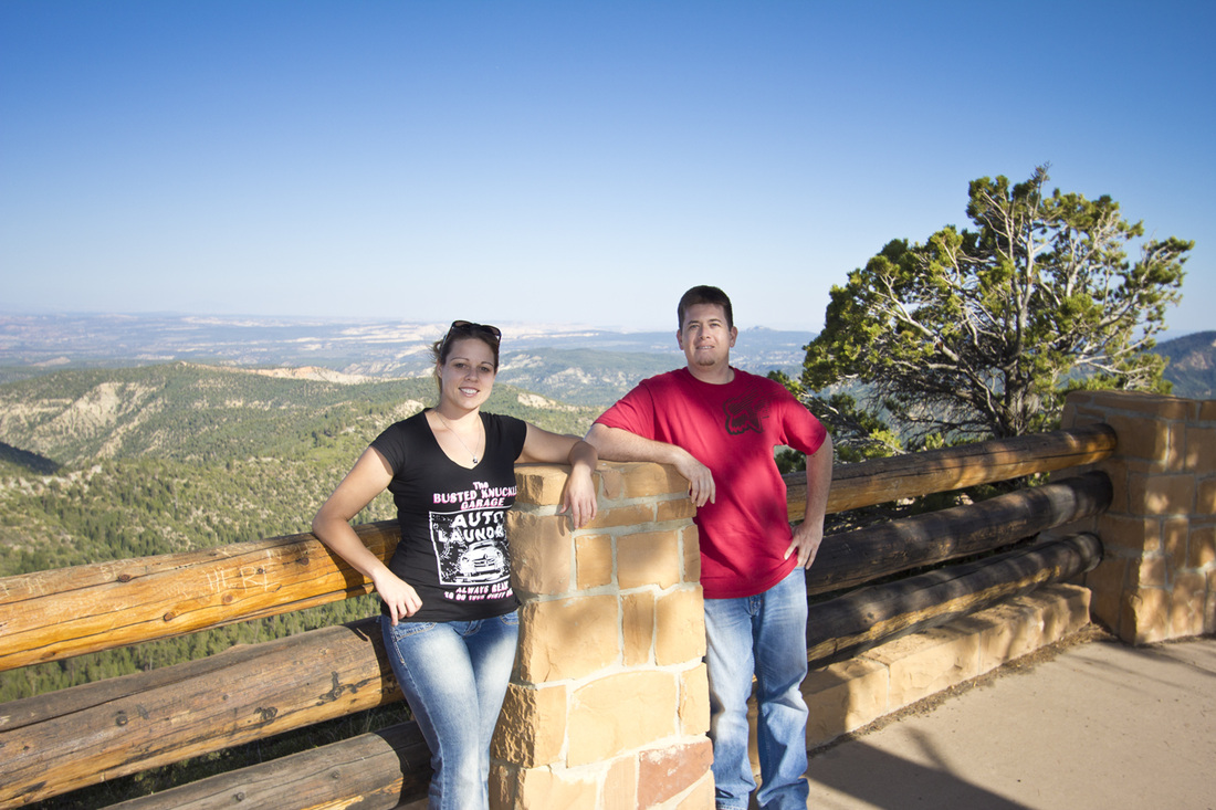
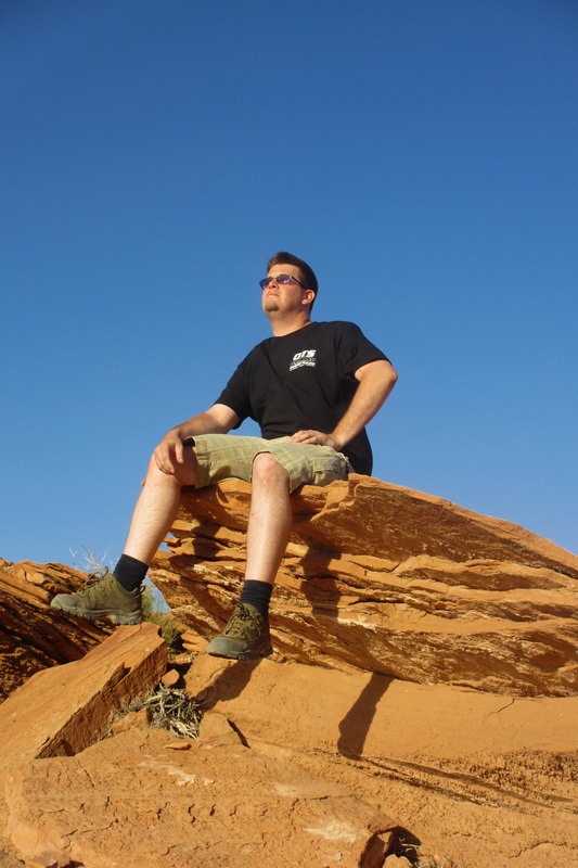
Sunday May 20th, we woke up and headed down south to check out Cedar Breaks and Bryce Canyon. The first stop was pretty neat, we looked around at the viewpoints, took some pictures and then drove on. On the way out we found another area which was known as Brian Head Peak which was at 11,307 feet, our highest elevation on the trip. We spent some time walking around, using nature as a toilet, taking pictures and then were off another 60 miles to Bryce Canyon. Bryce was exceptionally cool because prior we had made a few stops to locate special glasses for the solar eclipse. We were unable to find any, and at the gate Bryce gave us out two sets of glasses! Pretty much from the time we entered the park till dark the eclipse was happening, so all the visitors were busy staring at the sun. We took a few moments to look, and then had the park to ourselves! Finally we left the park around 9:30pm and had another 80 miles to drive to Hurricane, a city nearby Zion.
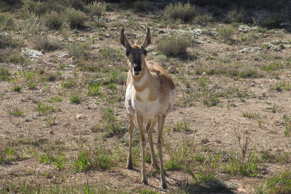
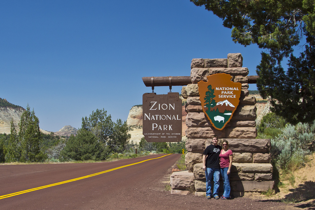
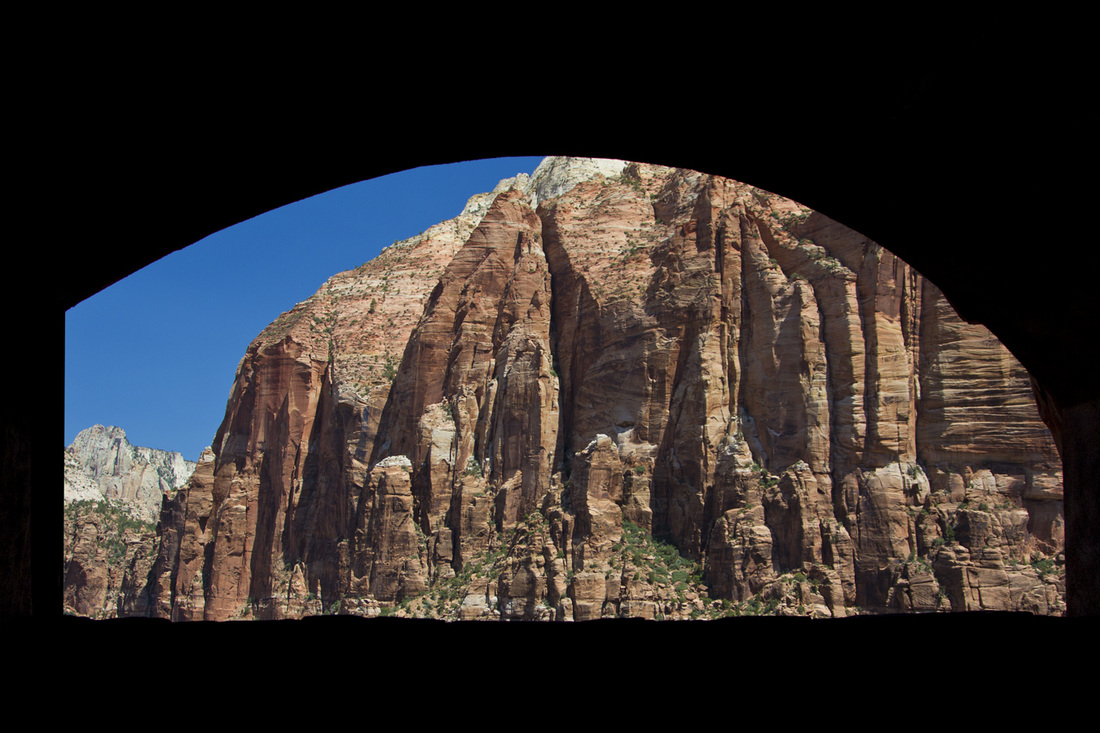
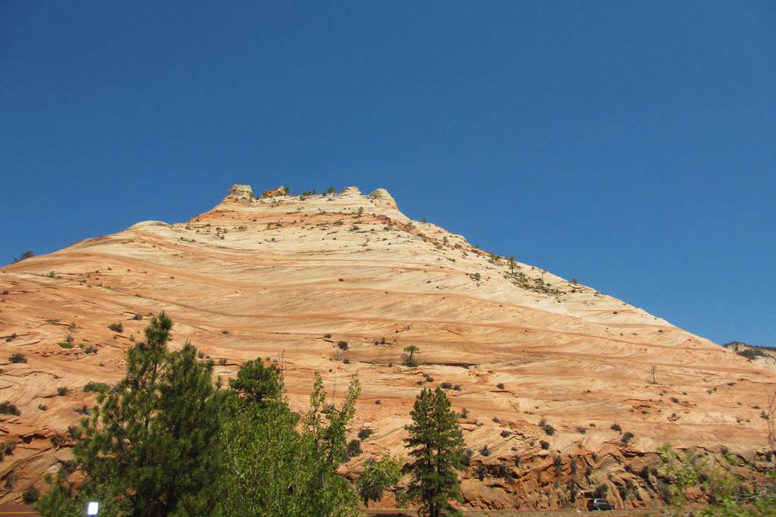
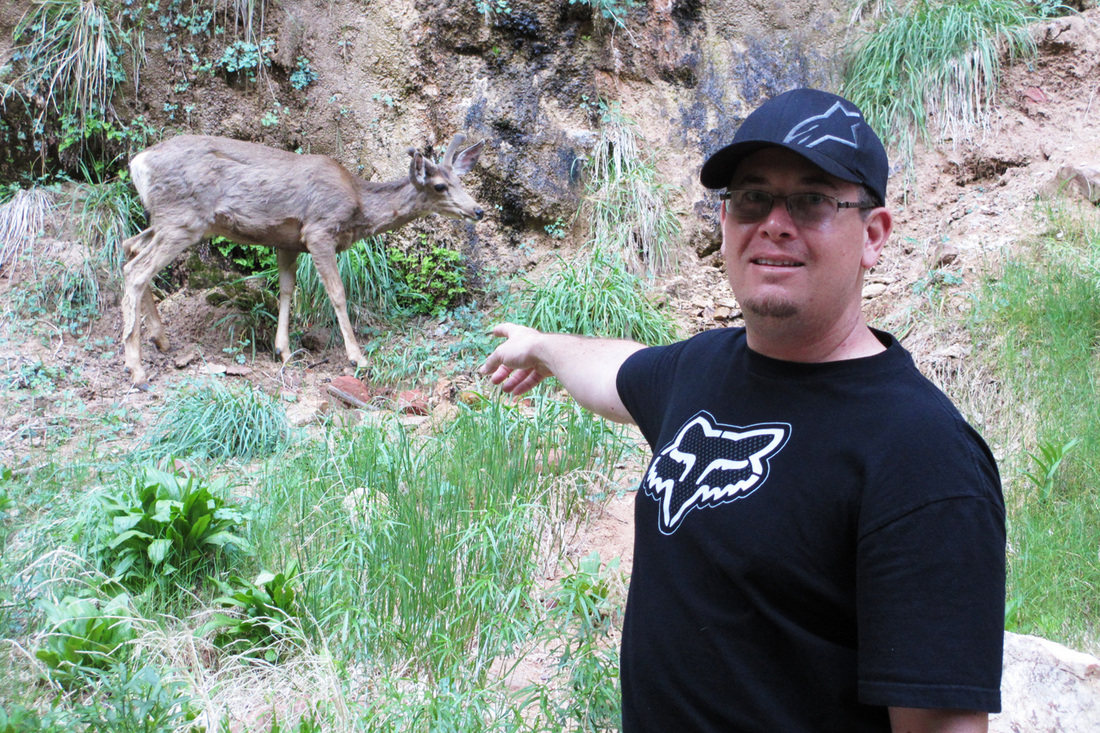
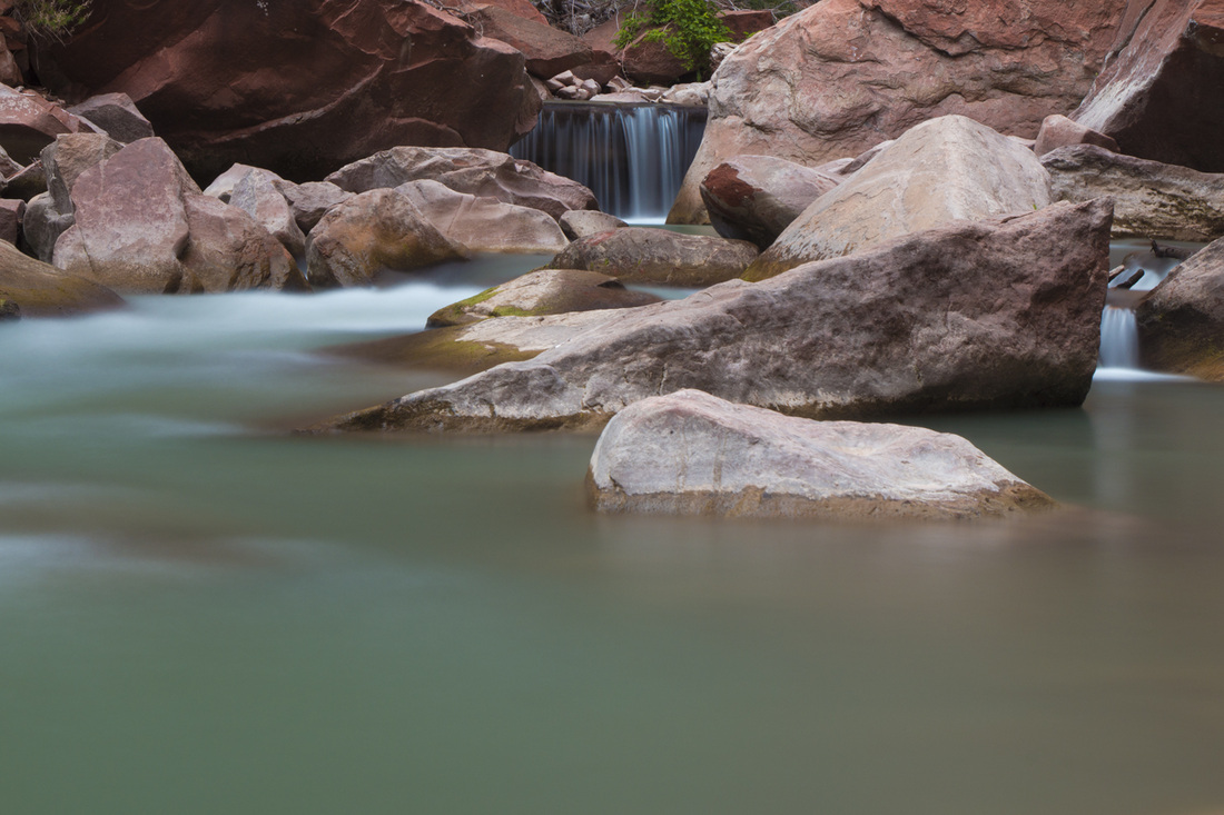
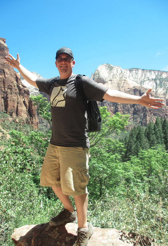
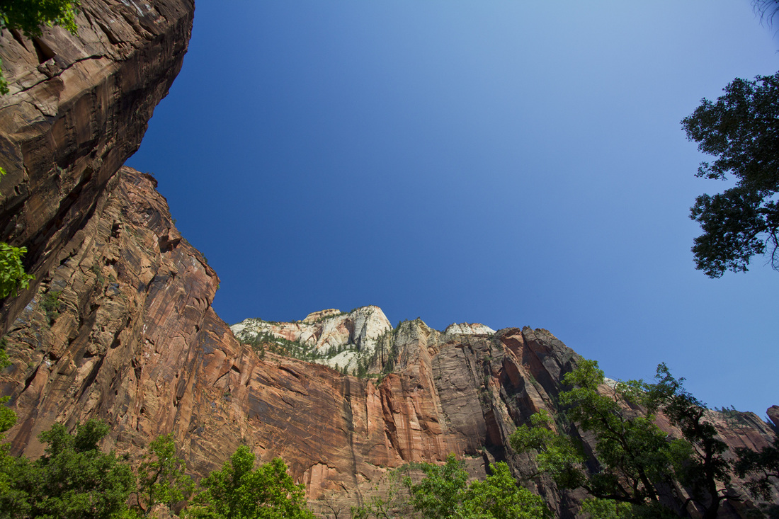
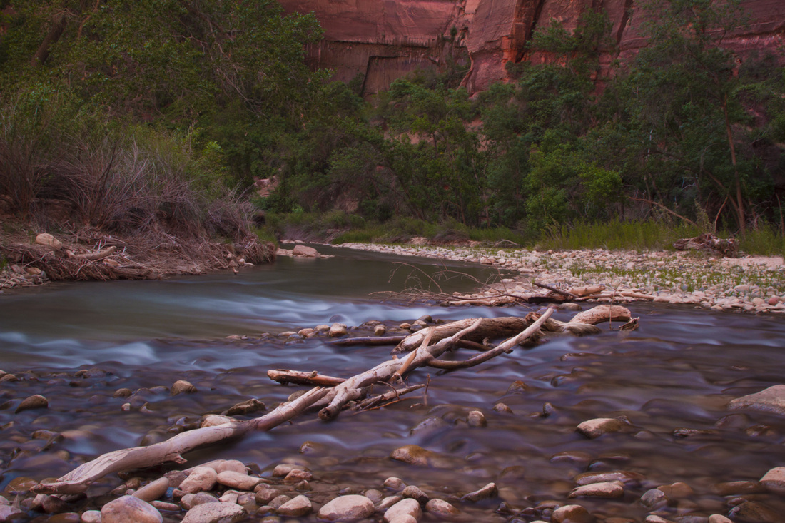
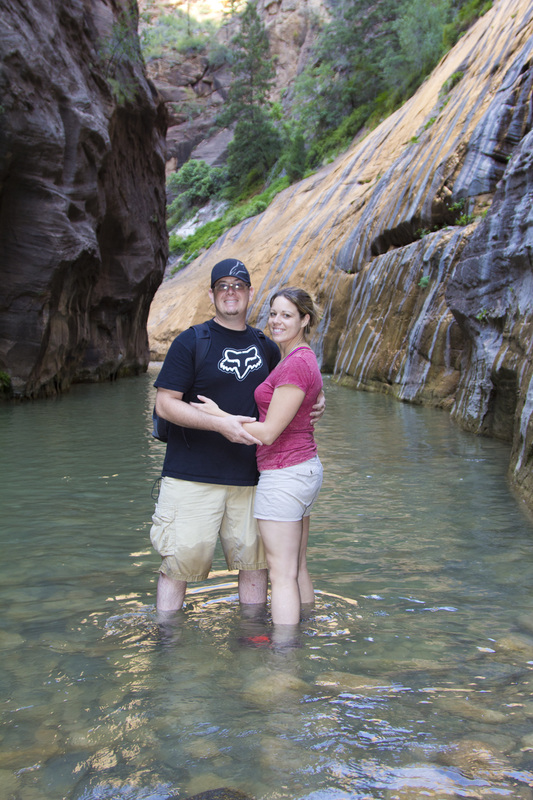
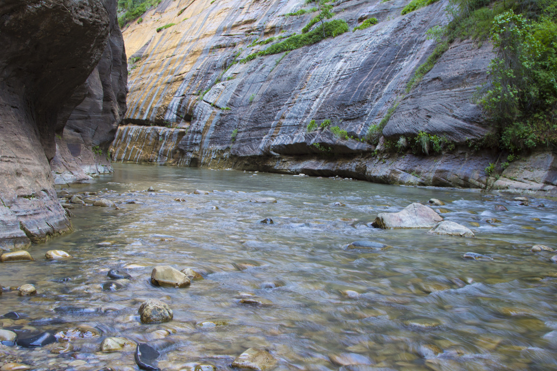
Monday May 21st, started off as a normal morning. I woke up and checked out the "free" breakfast while Chris was working on his beauty sleep. Wondered around at the hotel, packed up all of our stuff and we were ready for our first day at Zion. At that point we were close to the park so it was a short trip. Driving to the park we went through Springdale which was the gateway town into Zion. They had a handful of hotels, restaurants, an Imax movie theater and many touristy shops before reaching the gate. The drive though Zion is absolutely beautiful, there is no other park that compared to this. They had roads winding around a mountain with the exposed red sandstone everywhere. Then you make a 90 degree turn and are suddenly stopped by a ranger. Here you are sitting to wait to go thought he mile long tunnel that was carved out of rock in the late 1920's and completed in 1930. When it was completed it was the longest tunnel of it's type, which included windows that were cut into the rock to expose the outside landscape. After figuring out the bus system and what we had to do to get into the view-points and trails we were off. We first headed to The Narrows which is a trail through a river and the rock walls become extremely close. During this we seen numerous deer and squirrels. Chris was obsessed with the wildlife, I was not so much. The first part of this trail is a nice paved path and then you get to a section, that continues only though the river. We looked at each other, removed our socks and were on the way. Wow, melting snow is COLD. This went on for awhile, until we seen people getting to the narrow section and in water 3.5 feet deep. This is where we ended the trail, neither of us were prepared to be completed soaked. Thankfully our shoes were fine and we wanted to check out a 0.5 mile trail to Weeping Rock. On the way here, we seen more deer and Chris had to stop for more pictures but this didn't stop here. We then ran into two ducks, a squirrel and a young rattlesnake. This "weeping" rock was pretty neat, just had a bunch of water seeping though the rock and you were able to go up to a nice viewing area. This then concluded our day and we went to one of the hotels in Springdale for the night.
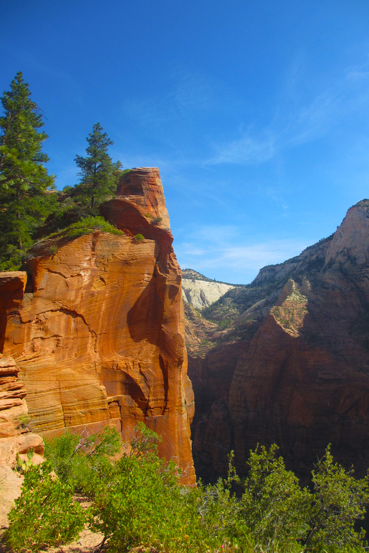
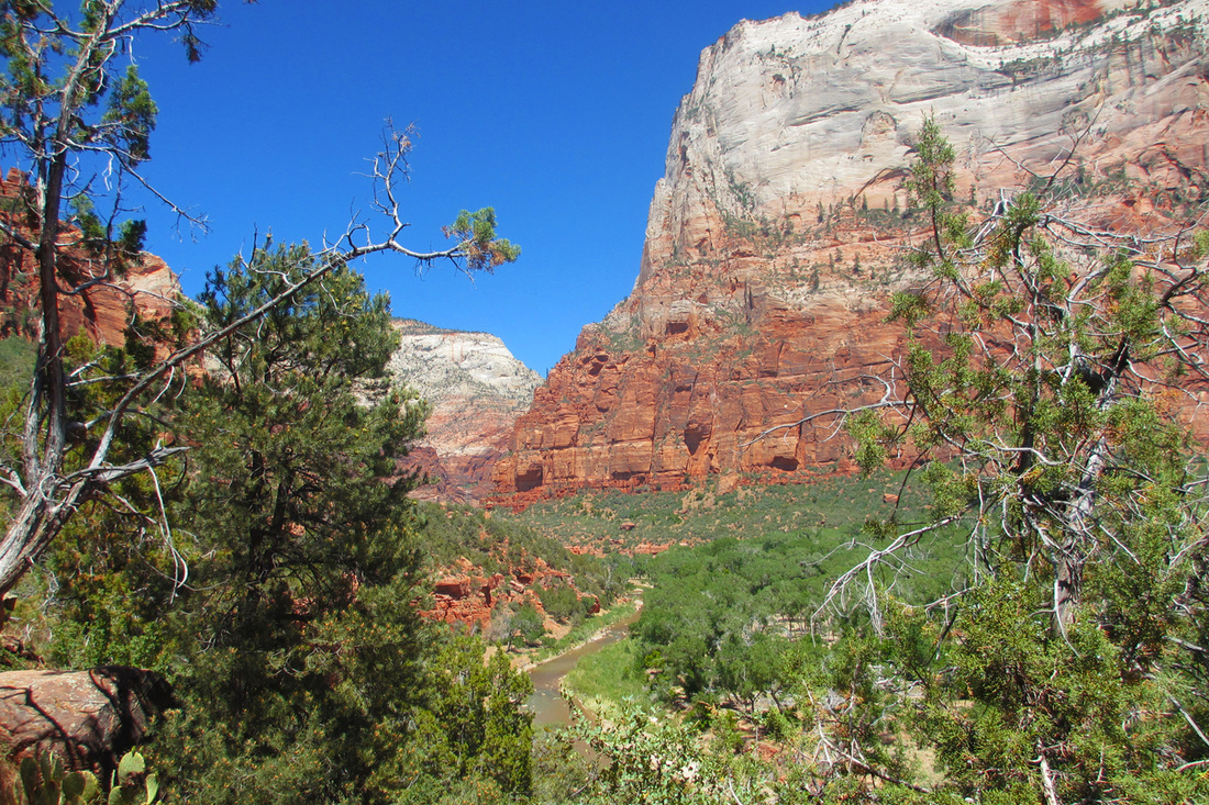
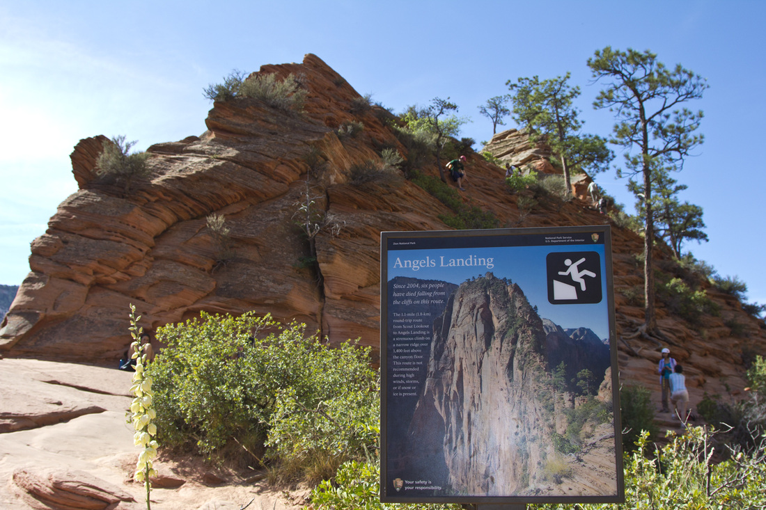
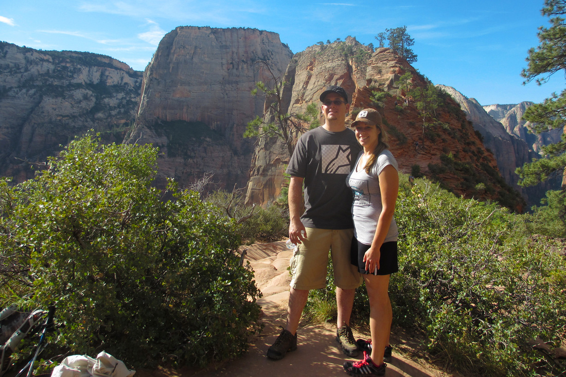
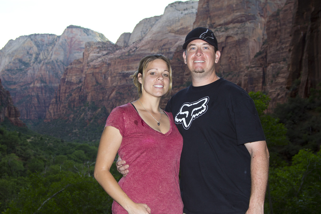
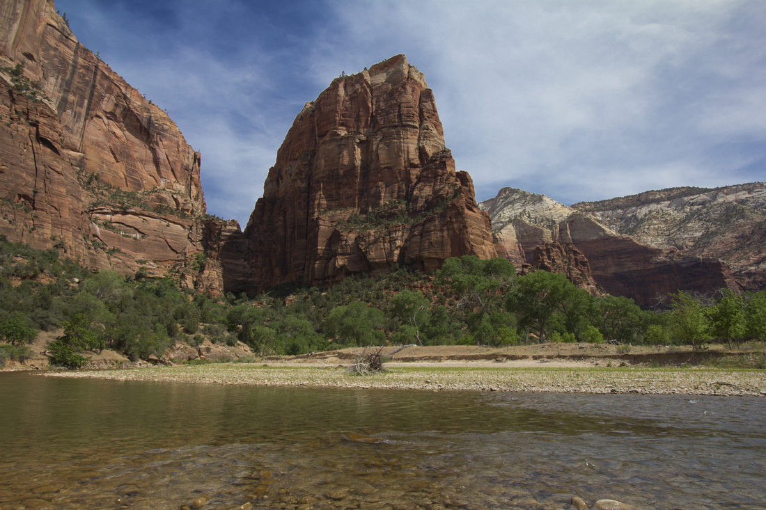
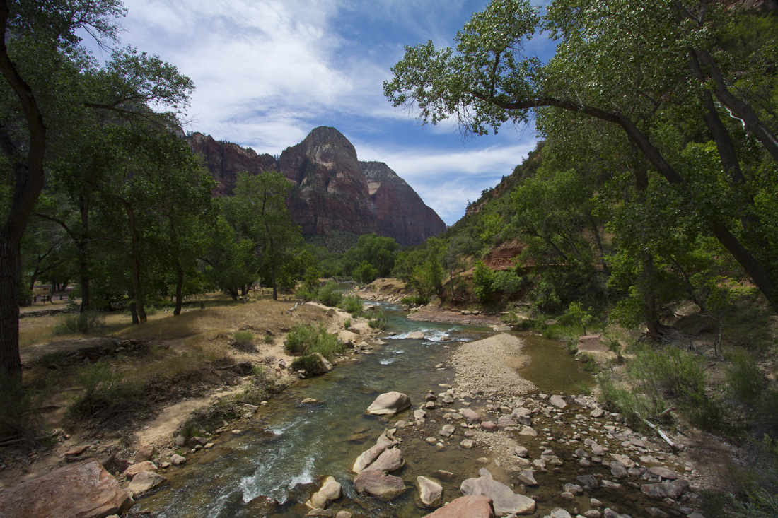
Tuesday May 22nd, today is Angels Landing day. We left the hotel right after 7am to get an early start. When entering the park you are handed a newspaper and map of the attractions. In every newspaper there is a section of available hikes. There are typically three categories, easy, moderate, and strenuous. Angels Landing is categorized as strenuous and to plan at least 4 hours to make the 5.4 mile round trip with an elevation change of 1488 feet. By 8 to 8:30am we are off the bus at at the trail head. The hike starts out moderately easy but the incline starts to increase the higher you go, we took numerous trips just to catch our breath. Oxygen is at a much lower percentage when you are at 5,000 feet instead of sea level as we are used it. You then get to the last 0.5 miles of the hike which is extreme. You are on a cliffs edge, physically climbing up rocks with nothing more than a chain to hold onto. Chris agreed to patiently wait as I continued on, it didn't take long for me to chicken out. You literally are inches away from falling more than 1,000 feet, I felt defeated and was disappointed that today wasn't the day to complete this. We hung out up at the top clearing area for a bit, Chris played with more squires and chipmunks and then headed back down.
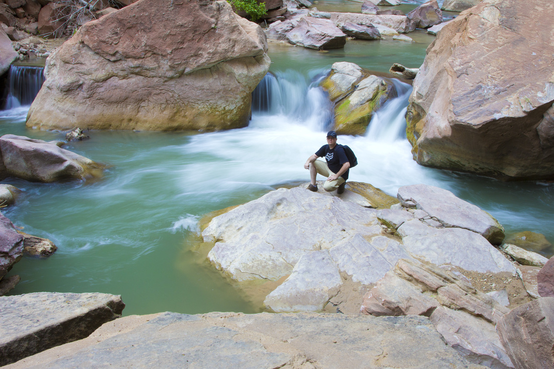
With 5 miles under out belts, we agreed to check out one more trail before leaving the park called Emerald pools. The catch is there is lower, middle and upper. To begin with we were just going to do the lower since it was considered easy and only 1.2 miles. It was beautiful and very enjoyable so this turned into doing middle Emerald Pools (moderate, 2 mile, and 150 feet), Upper Emerald Pool ( moderate, 1 mile and 200 feet incline), and then the Grotto Trail (easy, 1 mile and 35 feet incline). By the end of the day we had completed close to 9 miles in rough terrain and had hiked up and back down 1873 feet. We were both beat and ready to move on. Next stop was a hotel in Page, AZ, for once we arrived at a decent time and was able to Yelp local restaurants. Best reviews were a restaurant down the street known as Bonkers, yes it's a funny name but our options were limited. To our surprise it was wonderful, everything about it! Finally a good meal. Time for some sleep.
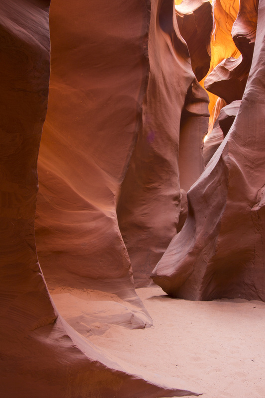
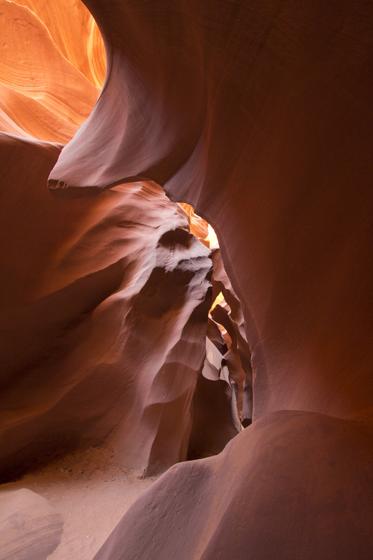
Wednesday May 23rd, a day to sleep in, but the time has changed and I'm up at 6am. I run about gathering information on Upper and Lower Antelope Canyon and how we can access it. Here I learn that the lighting is best right around 10-11am and you must go by a guided tour. Chris and I then discuss the options and head to Lower Antelope Canyon. Cost to access Upper Antelope Canyon is $50 per person and I read an article where Lower is actually prettier (also only $26). We drive down these dirt roads and show up to a parking lot with a makeshift shanty attached with the Navajo Indians collecting the large fee for you to enter their land. We are then escorted down into the canyon and are allowed two hours. No words can explain how extraordinarily beautiful this was. I tried to take my time and capture some good pictures, but it just does not display how deep you end up going and the natural beauty the water has created in the rock. Ultimately it was worth the $26 per person to see this in person.
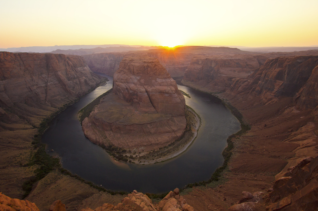
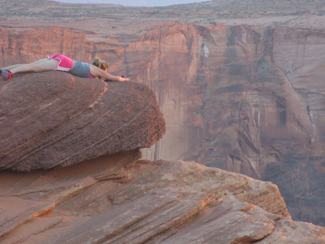
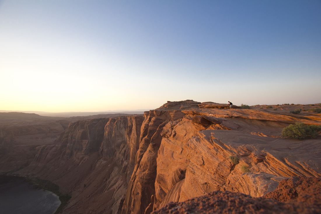
After Antelope we drove around scouted out where we needed to go for Horseshoe bend (within the area), arranged a boat ride for the following day. I then figured since it was later in the evening that we would head back to Horseshoe Bend around 6pm to make sunset. When arriving it was close to a 0.75 mile walk to get to the edge and look down 1,000 feet at the Colorado river to what they called Horseshoe Bend. Besides the 50mph wind gust, the weather was beautiful. We concluded our day just after sundown and rested up for a new tomorrow.
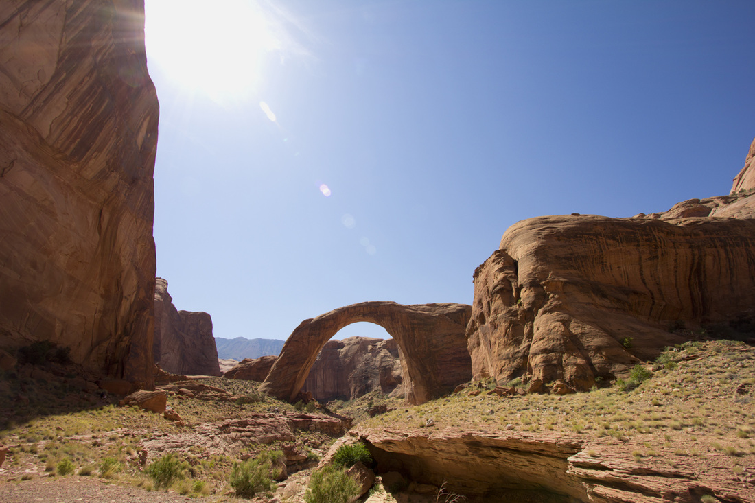
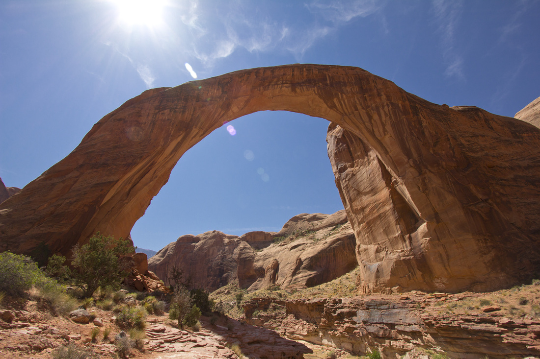
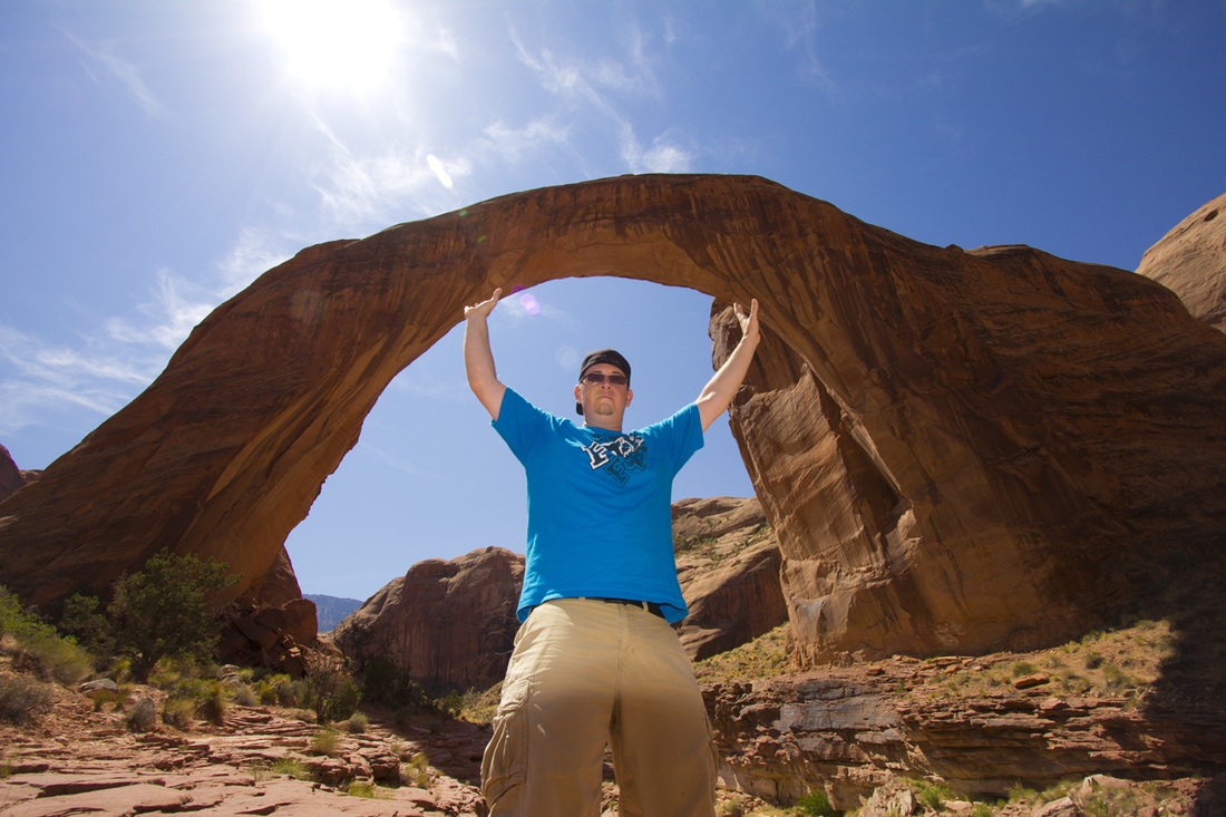
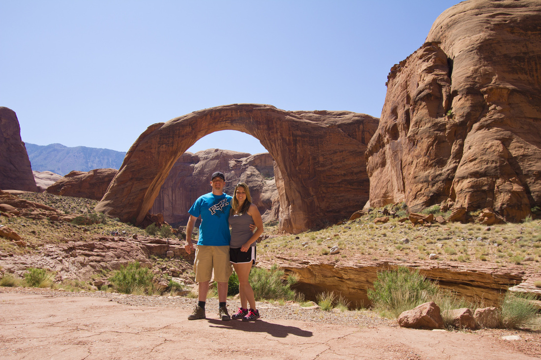
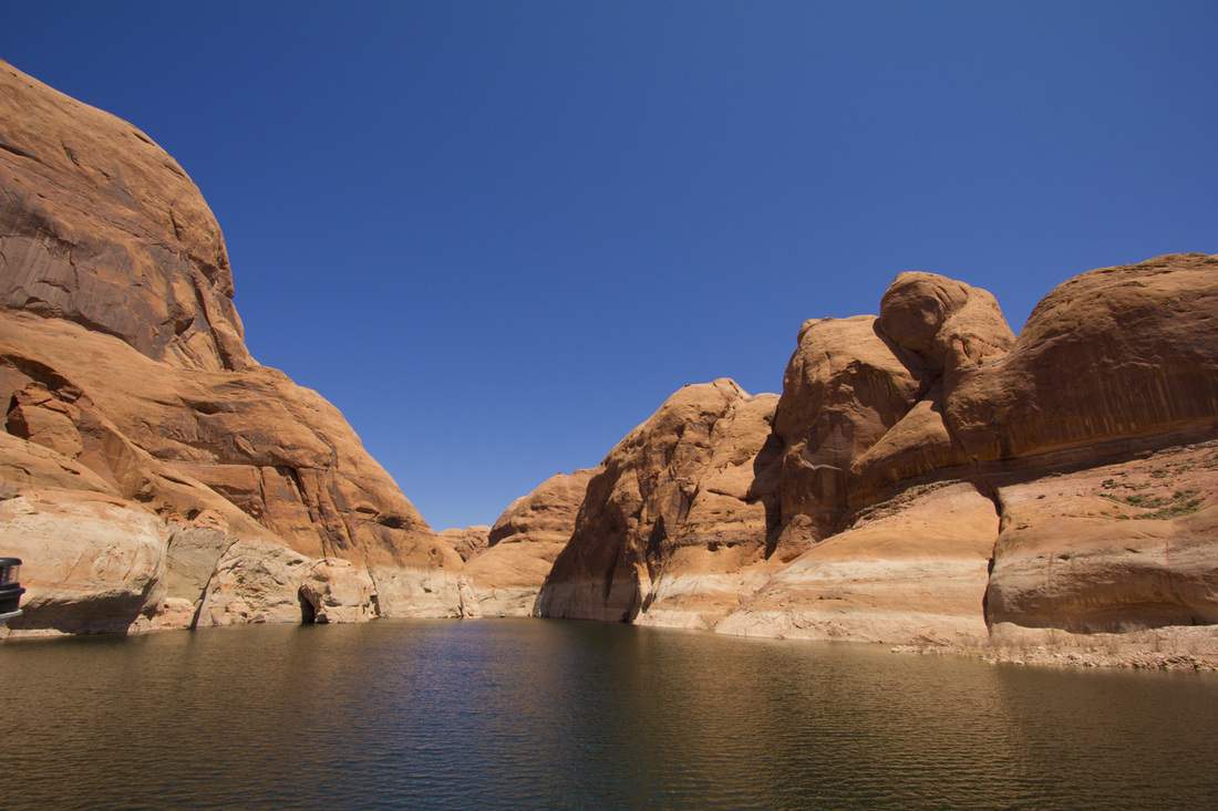
Thursday, May 24th, Boat ride day! Chris has been waiting to relax on a nice soothing 50 mile ride on Lake Powell to Rainbow Bridge. We arrive before 7:30am and as we board the ship (it was only about 1/4 full) it takes off almost immediately. We made the wise decision to stay below and will ride in the upper area on the way home when warmer. Very comfortable enjoyable ride, and the scenery is just amazing. Once we docked we were given an hour and fifteen minutes to hike the trail and view the bridge. Rainbow Bridge was certainly neat and is claimed to be the largest natural bridge in the world. It's the boat ride that made this trip so enjoyable. Another 2 hours and 50 miles, we are back at the Marina. Technically we are in the Glen Canyon Recreational area and so we take the time to enjoy a nice picnic lunch at one of the overlooks provided before making the 120 mile trip to the Grand Canyon. After using the facilities we are on the way to one of the 7 natural wonders of the world.
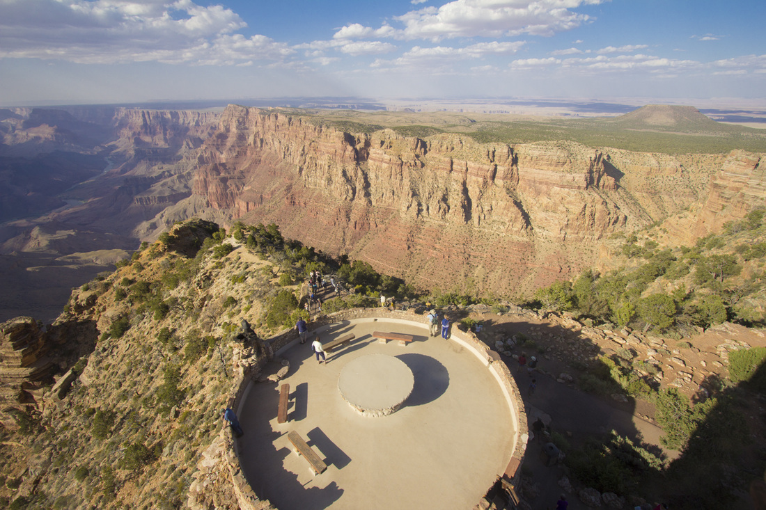
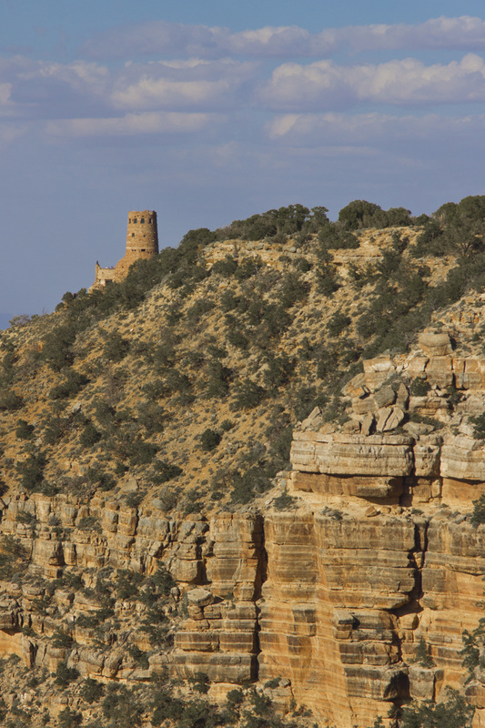
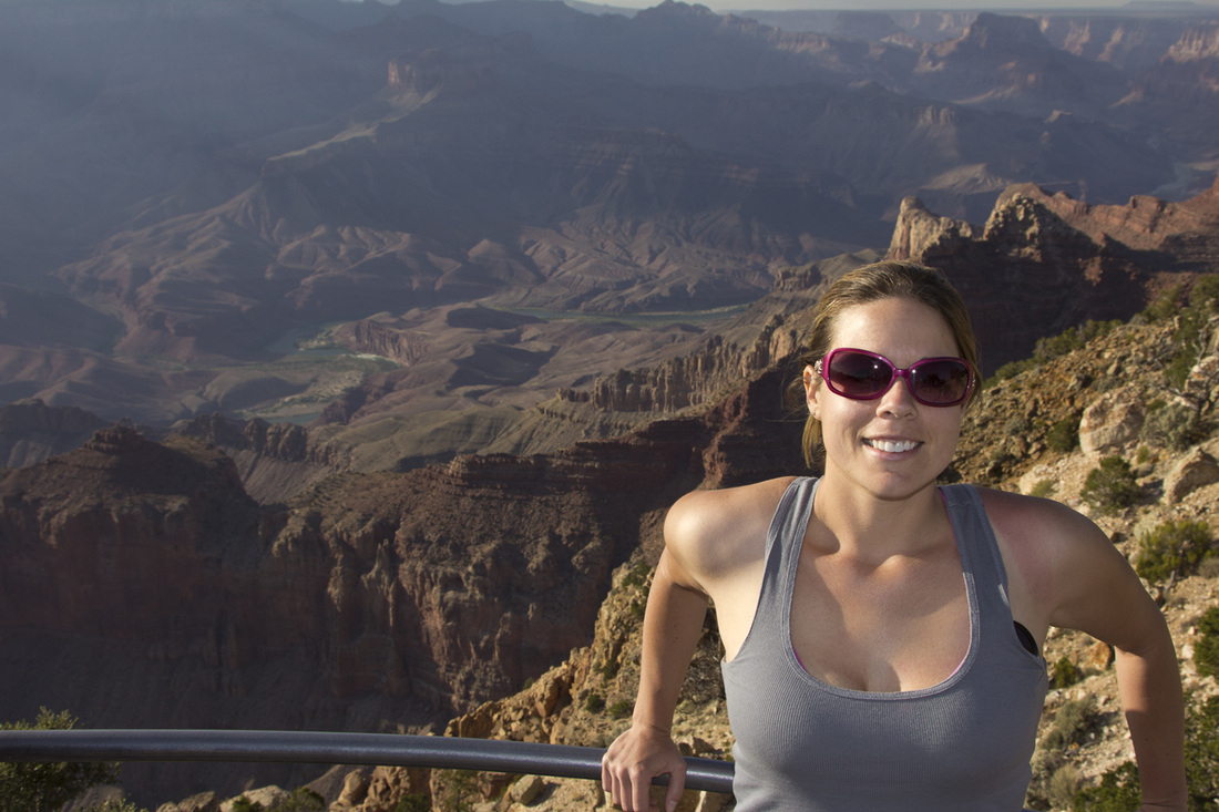
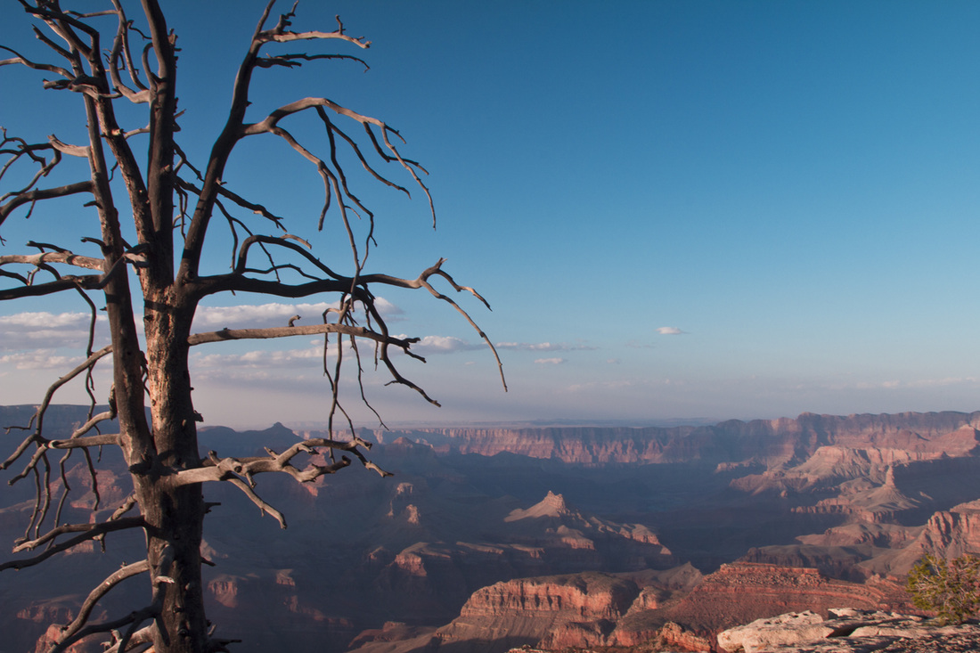
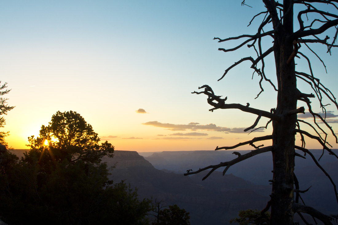
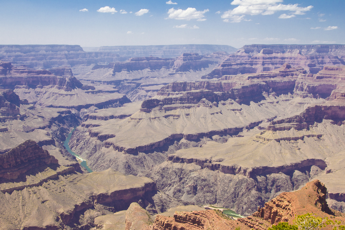
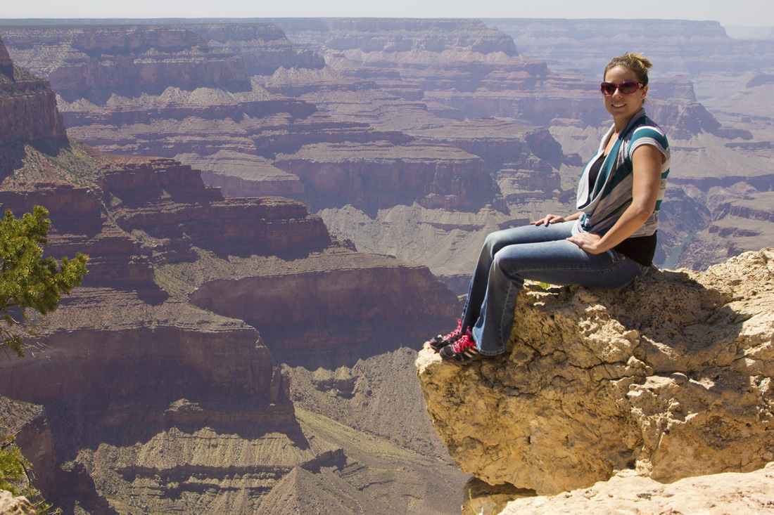
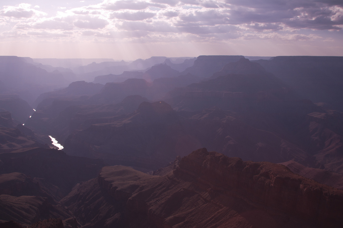
When you enter Bryce Canyon, Zion or some other areas we have been the drive is just overwhelming beautiful. Entering the Grand Canyon was like going into a forest. We pull up to the gate and are given instructions it is 26 miles until reaching Grand Canyon Village. It's not long (maybe 1/2 a mile) before coming up to the first scenic view point. Now is where you are just astonished how there is this big Canyon right below you carved into the earth. We stop at a few more view points along the way, take pictures, wait for sunset and head to the hotel.
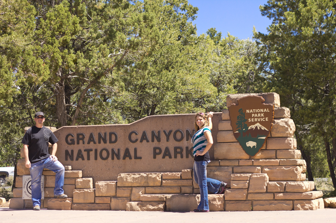
Friday May 25th, we should go ahead and categorize this as chaos day. First waking up this was probably the nicest hotel that we have stayed in, unfortunately the cost went along with it, but did have a huge buffet breakfast included. So we are over 500 miles away from the Condo in Sandy Utah, and have no plans for the evening. A brief meeting concludes we are going to go up the eastern part of Utah and check out Arches & Canyonland on the way home. "Why not, we are all ready here!" This became something we repeated many times. I grab the iPad and go to breakfast with intentions of finding us somewhere to sleep that night. Moab, is the town bordering the two parks, so I start looking. The first hotel I called was over $300 a night, so next I call a Super 8 which was still $200. This is ridiculous, so new plan of action, I look for hotels along the way in no name towns/villages. After all we just need to shower and sleep for the night, so I locate a family owned reasonably priced one. Room booked and we are ready to start the day. So next I call to check in on our friend Matt, who is working for Grand Canyon Airlines and doing tours daily. He was able to hook us up with a free tour around 11am. To my huge disappointment and Chris's happiness the winds are estimated at 40-60mph and they have cancelled all flights for the day. Higher winds also throws up the sand creating less visibility. Well we cannot control the weather, and it's better than rain.
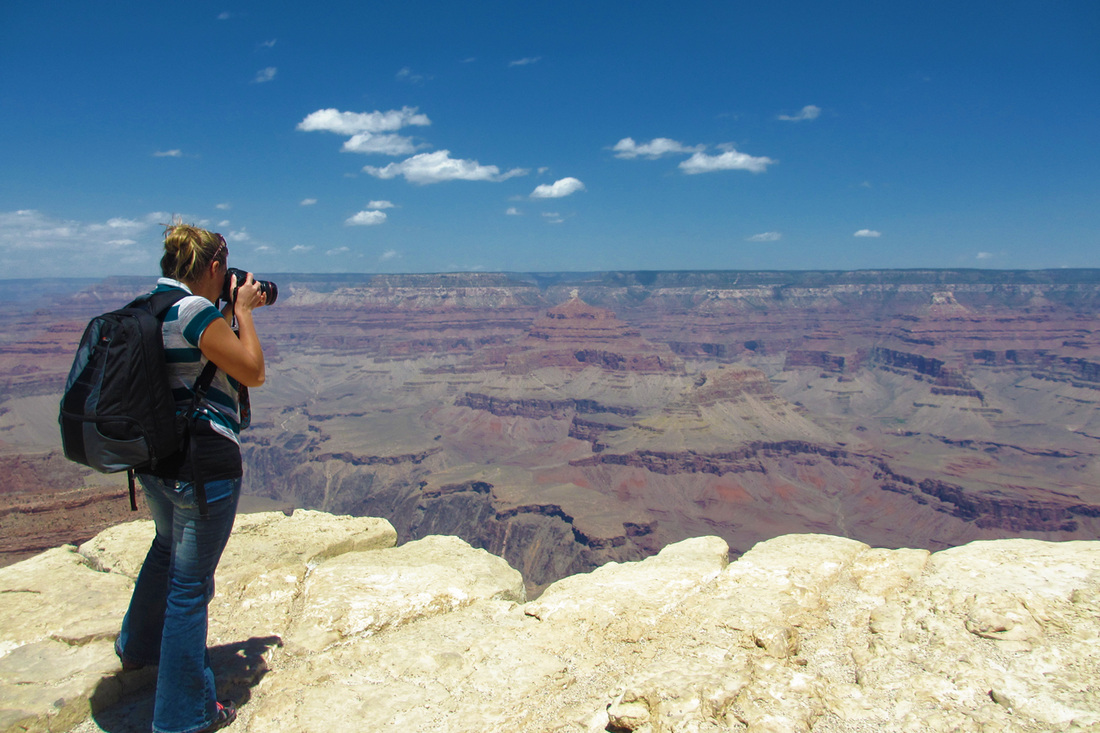
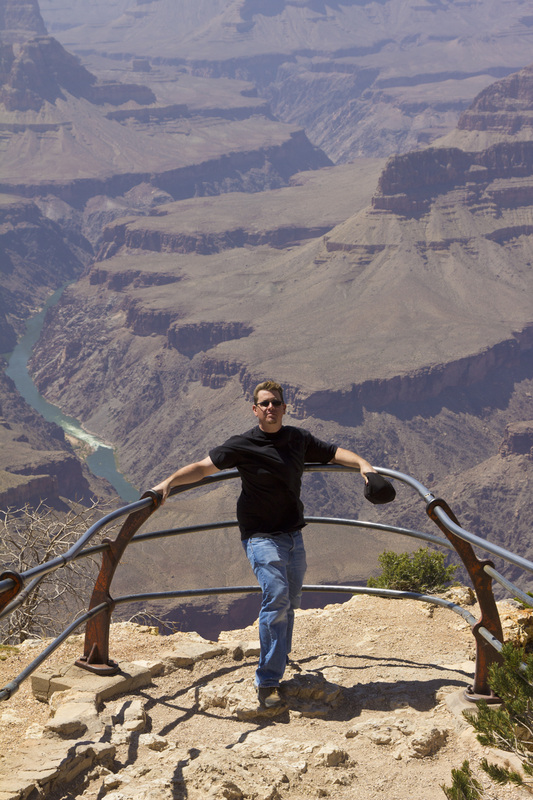
Let me remind you that this Friday is the start of Memorial Day weekend, and tourist are everywhere, us included. So we head into park to check out a few more viewpoints. First many of the popular view points are only accessible by bus. We park the car and pick up a schedule of where we need to be. So we grab the blue bus which is PACKED make a few stops to get to the red bus, which is even more PACKED. The bus driver is literally screaming at people over a loud speaker which has the volume turned up to the max. We are on this red bus for approximately an hour before getting to our first destination. The look outs are just amazing, we take pictures and just look around for awhile. After being on over packed buses and knowing we were on a time scheduled due to the 300 mile drive we had to make, we made the decision it was time to leave the park. This is where the next problem occurred, it probably took 2.5 hours for us to take the stupid buses 5 miles back to the visitor center. This killed the whole experience of the Grand Canyon.
Finally we are OUT of the park and on our way to this no name hotel in Monticello UT. On our way up the east side of Utah we notice the the Four Corners is only 45 miles out of the way, so we get the bright idea at 10pm at night to swing by and see if we can get to the actual area. Now this is Indian owned so of course the like to charge people for everything and have their strict guidelines. So I look up the options to go after hours and read that the fence is not hard to get around but you may be greeted by dogs which are mostly friendly. We make the decision to give it a try. Here we are in the middle of the night, traveling in the middle of no where to hit the four corners, finally pull up to the gate which is 6' tall, and had hand painted signs "no trespassing" all around it. We turn off the headlights to the car and the darkness is overwhelming. Nothing is illuminating the sky except for the thousands of stars, not a noise to be heard or a car passing by. Looking forward towards the attraction, if we made it over the fence, we would have quarter mile walk to get to the four corners. It's just Chris and I, we have no weapons and nothing available to defend ourselves. We both wise up and abort climbing over the fence and leaving the car unattended in the middle of no where. Though this little adventure, we did travel into Arizona, New Mexico, Colorado, and Utah.
We are then back our our way going down small two lane roads without seeing any other vehicles. We are driving fast (you know to make up time for our 80 mile off track adventure), real fast and I look up, not understanding what I'm seeing just yell, STOP. Chris suddenly slows down the car to a horse standing in the middle of the road. We are now at a complete stop and this horse, whom appears young is staring at us, wonder why we are bothering him. It's a brief moment of, we do not see anything like this in Florida! I then get out of the car to locate an apple, but me opening the car door was enough to move him off the of the road, and we are back on our way.
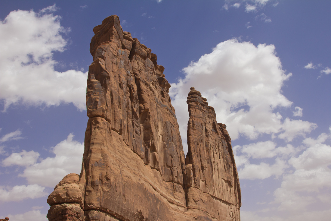
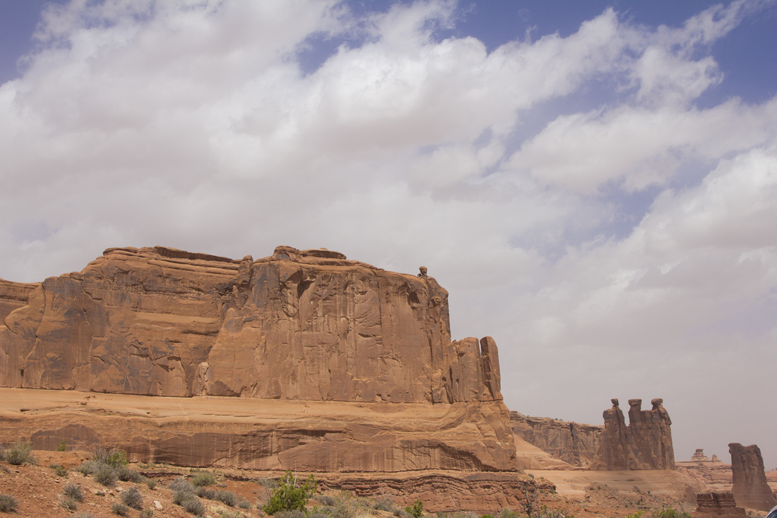
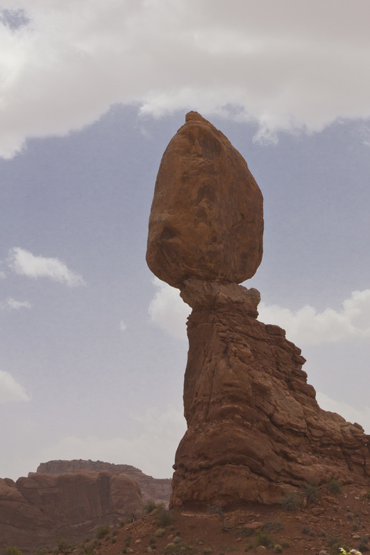
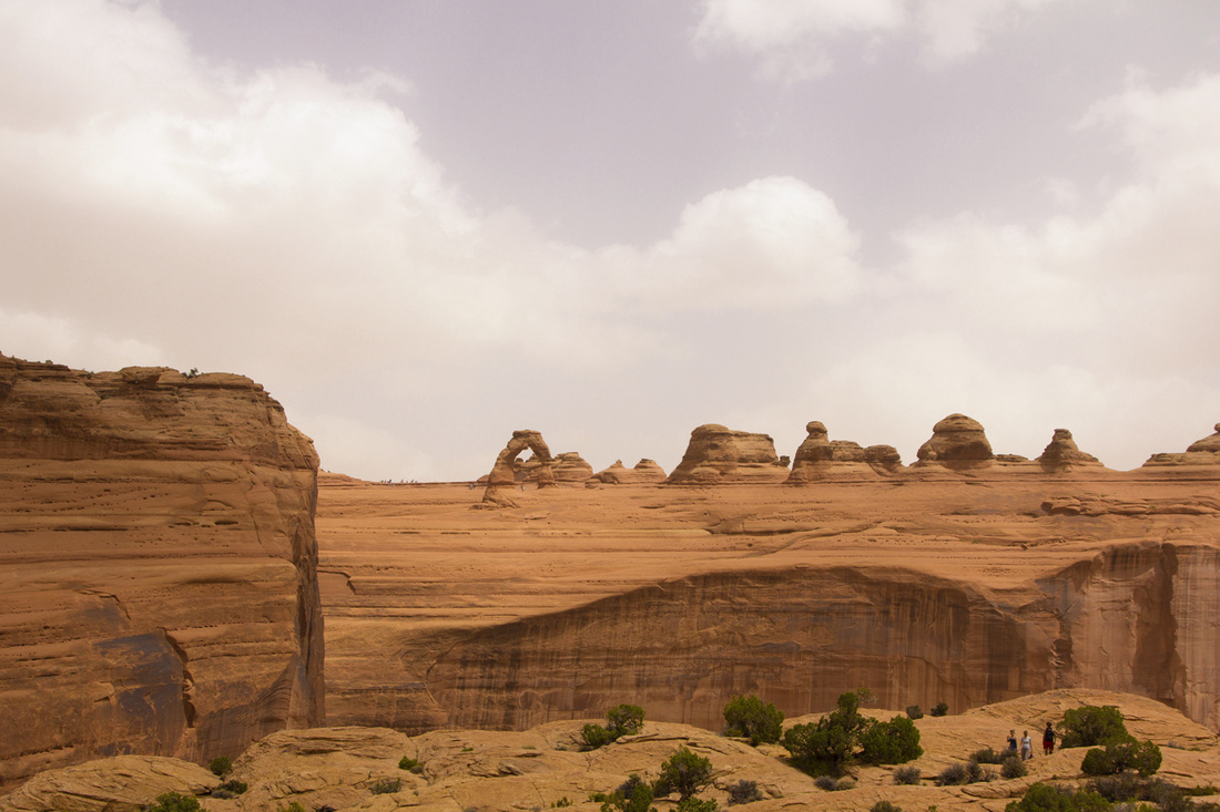
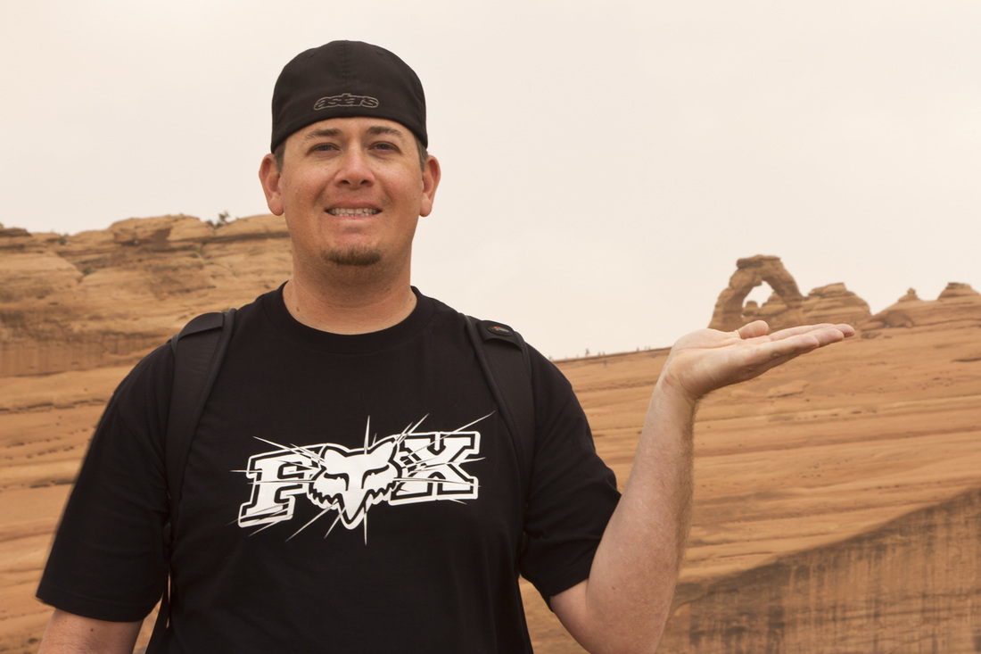
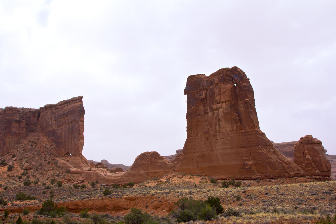
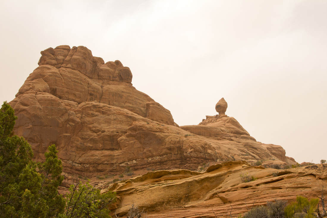
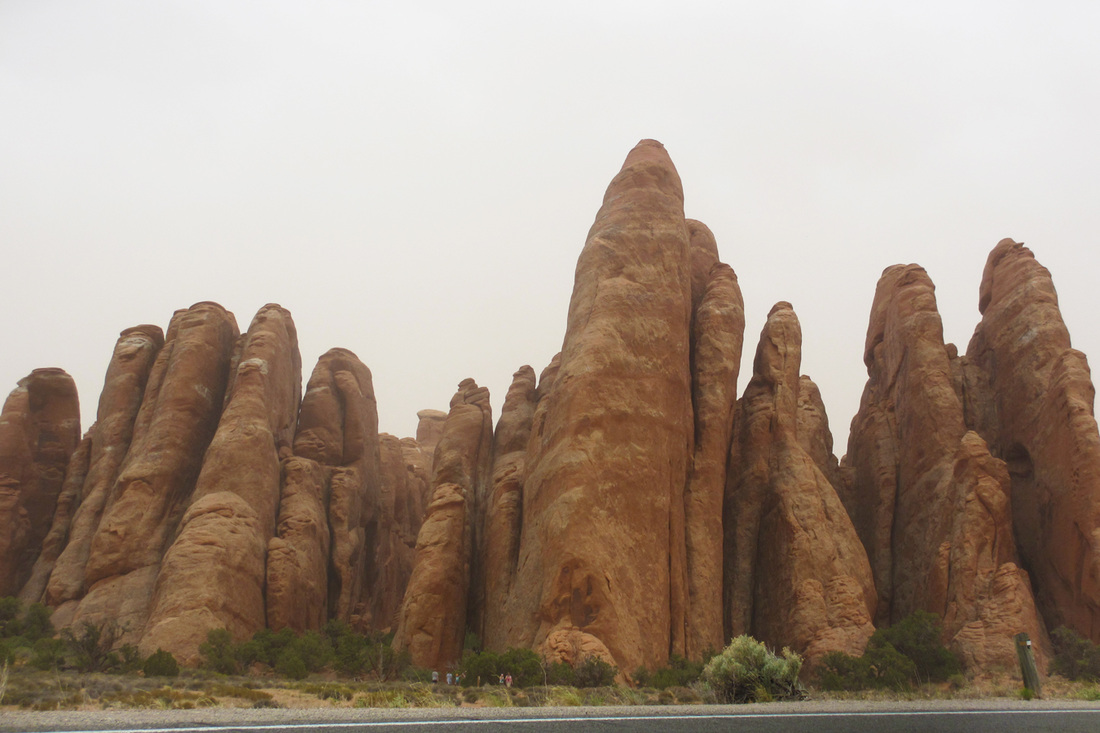
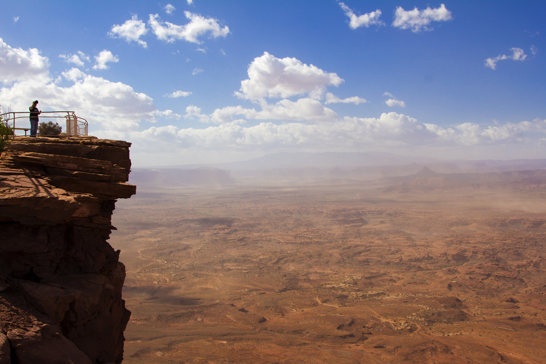
Saturday May 26th, we wake up in this deserted town in Monticello UT in a crappy little motel! So I grab a map and see Needles Overlook on the way to Moab. We both agree "Might as well, we are all ready here!" and are off on our way. The overlook was neat, but the winds were gusting from 45 to 65mph and throwing up sand everywhere. Besides getting hit with sand it also ruins the view and just makes it look like a brown fog. The overlook was nice, but was a good 25 miles off of the highway and was nothing extraordinary. So moving along we then are at the entrance to Arches National Park and start the drive though the park. We knew that we were on a time scheduled and had only figured on stopping at a few places including delicate arch. Delicate arch is one of the most popular arches due to the fact it is displayed on the Utah license plate. Offered was a viewpoint area with an easy 1 mile hike or a strenuous 1.5 mile hike that would put you right at the arch. We were tired and opted for the viewpoint. With time to spare we then drove around the rest of the park taking in the scenery. The rock formations are just amazing. We missed many of the formations due to you had to hike, and we were short on time and energy. If ever in the area again, I would love to see Landscape Arch, and spend some more time at the park to do some hiking.
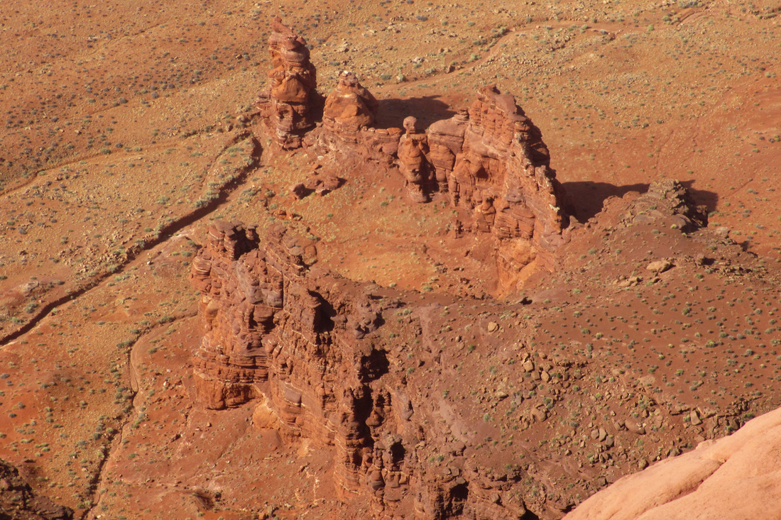
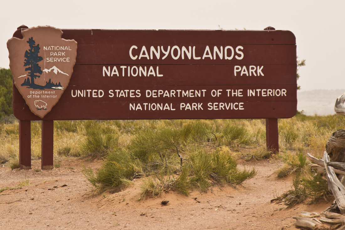
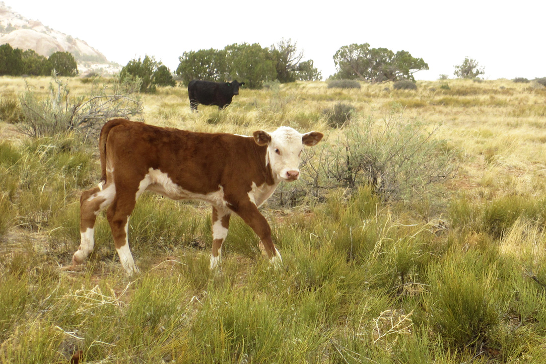
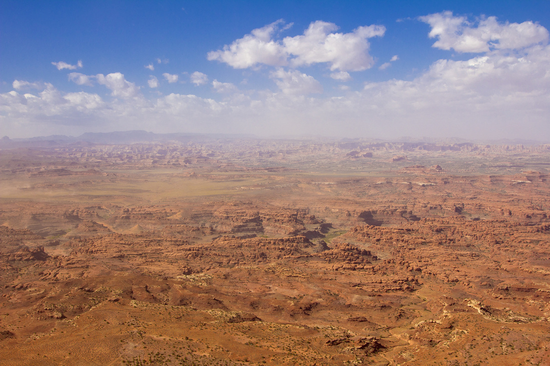
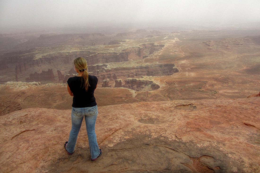
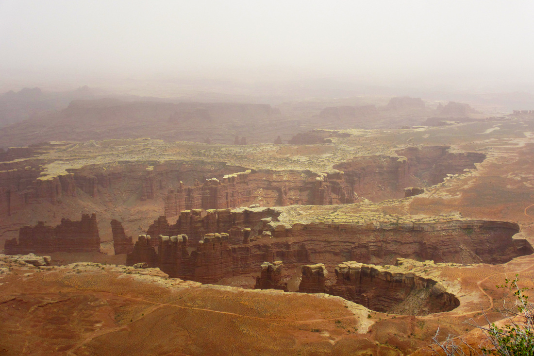
Next area to visit is the actual Canyonlands which was highly recommended by a friend of ours. We take the road that leads into the main entrance of the park and are just traveling along with fields stocked with cattle. Eventually we get to a entrance station that is deserted and a sign on the window stating to stop at the visitors center to pay the fee. We drive up further along and come across the visitors center which we stop at. We then drive though the entire park just sigh seeing and stopping at viewpoints here and there. Overall the park has some canyons and nice viewpoints, but everything else we had seen up to this point made it look uninteresting. We probably would not visit this park again unless by a 4 wheel drive vehicle and was able to try some of the off road trials. Finally back to Garrets Condo!
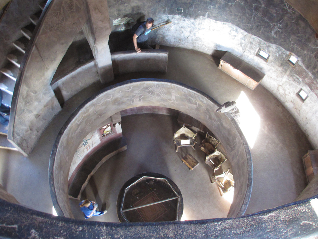
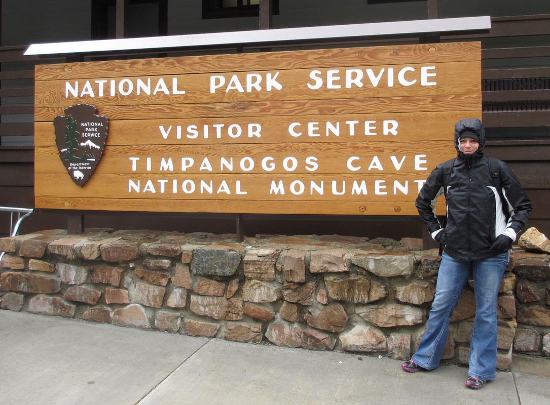
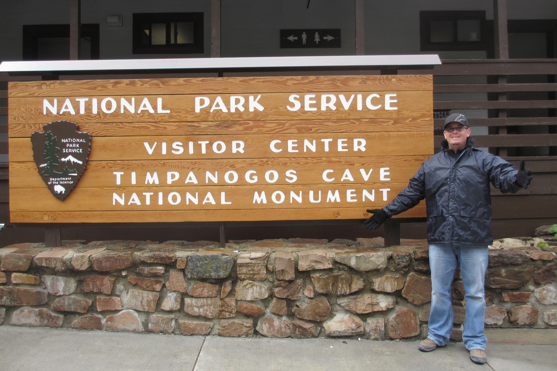
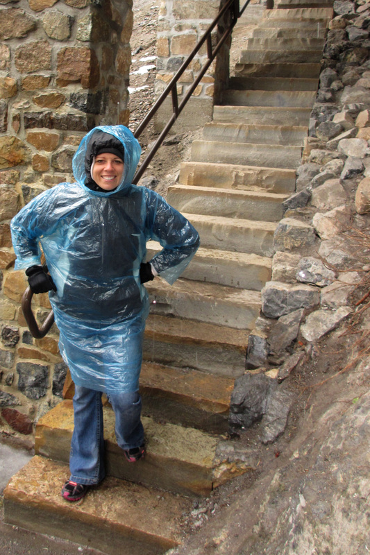
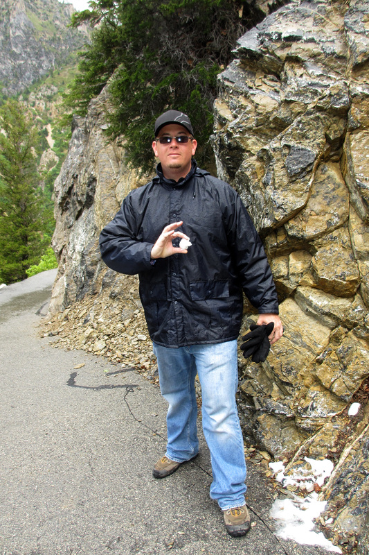
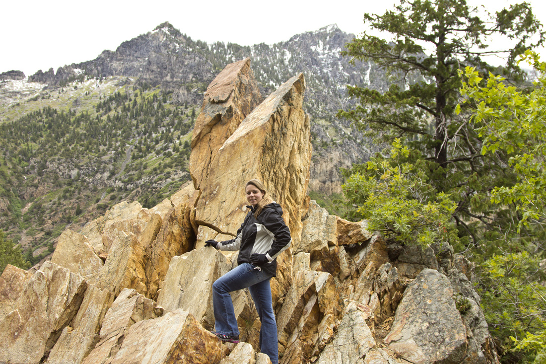
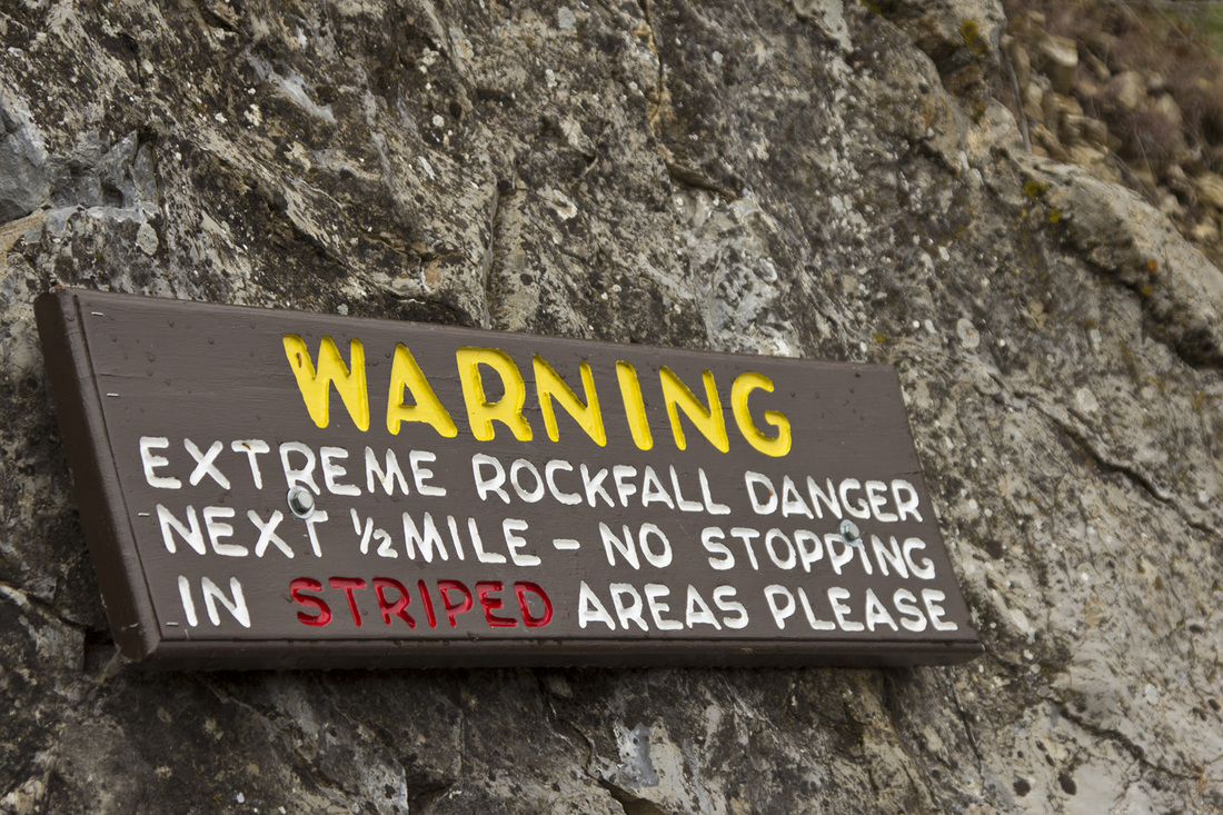
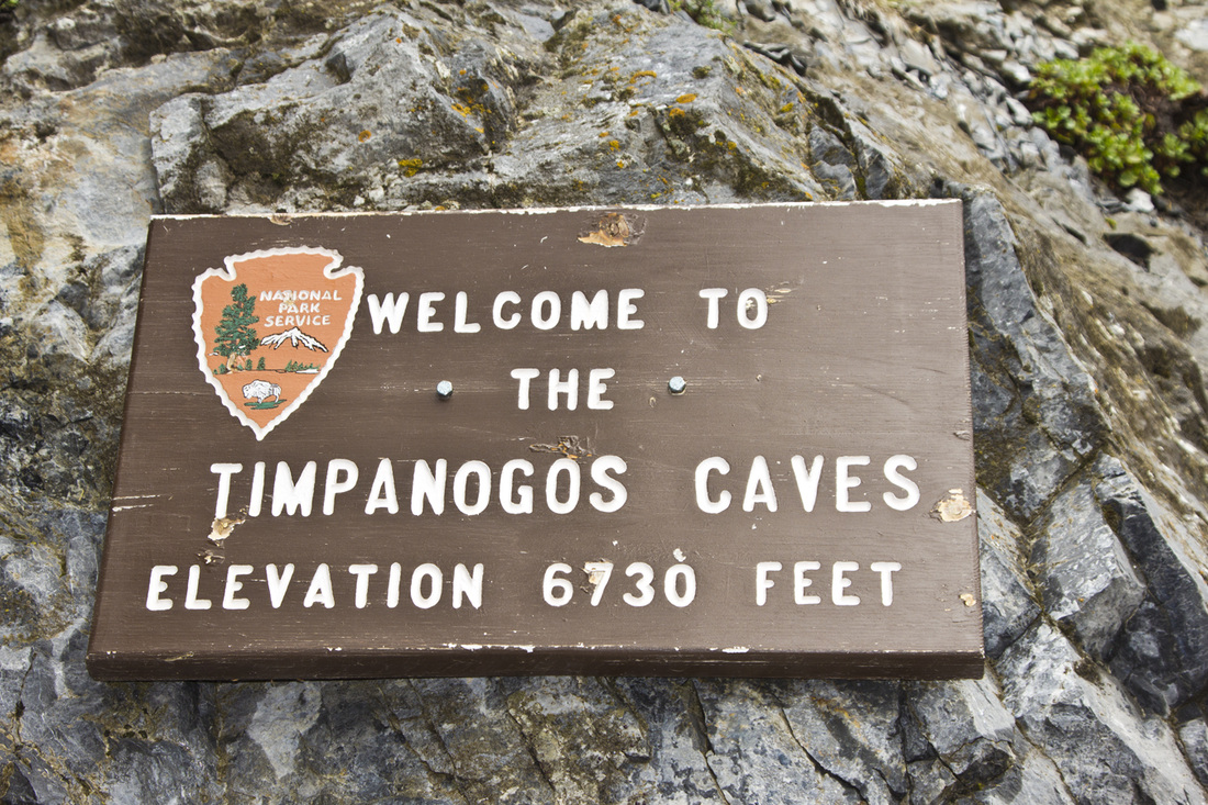
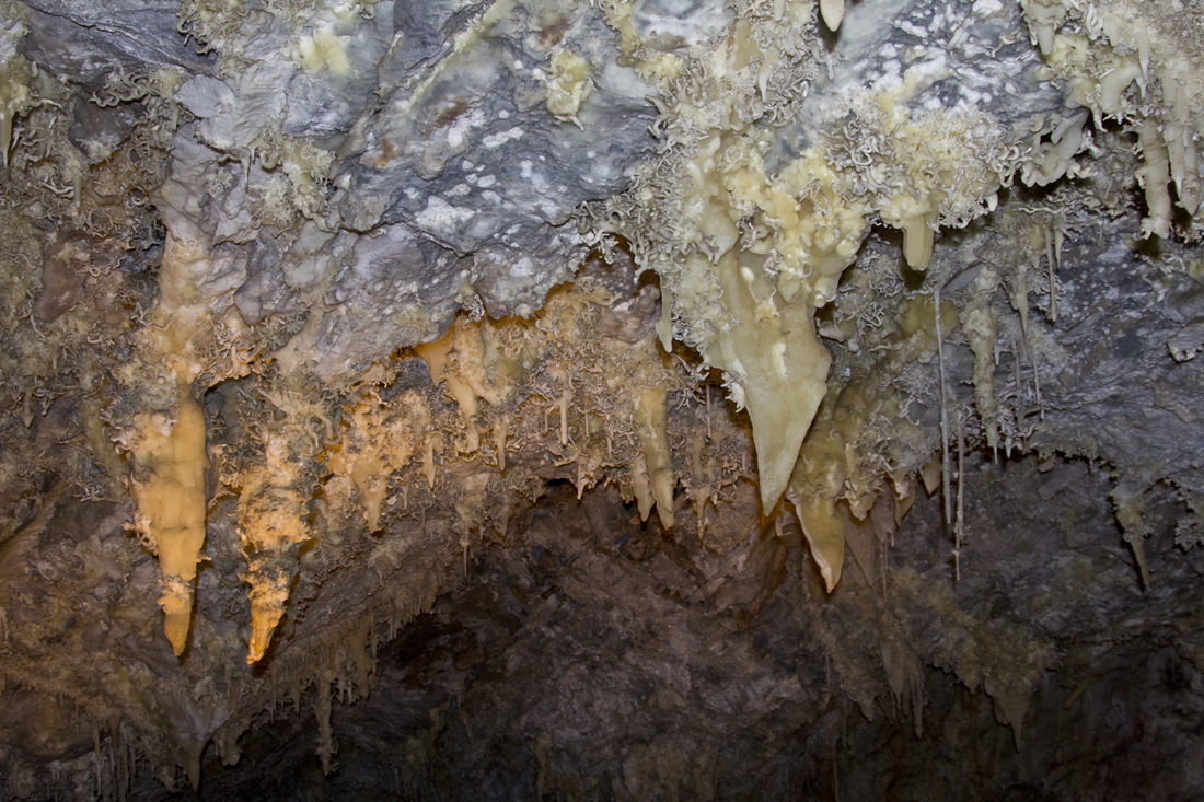
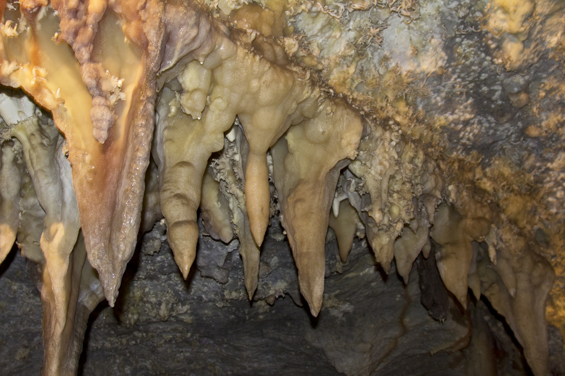
Sunday May 27th, relaxing was short lived. I was up early and talked Chris into going to Timpangoes Caves which was a national park right in the area. The expectations were not all that high since no one mentioned this park or had I ever heard of it. First you need reservations to even go into the cave and you can purchase tour tickets in advance, since they do sell out often. Being memorial day weekend we got lucky that the weather was debatable. When leaving for the cave, it was actually raining, but we keep our spirits high and was prepared for rain and cold weather. As we were entering the park vehicles were leaving with snow on their windshields, they had just experienced a heavy snow and sleet before we arrived. Tickets were not a problem at all, the issue became we had to hike up 1.5 miles and 1100 feet to even start the tour! All bundled up with water in hand, we start the journey, to be quickly stopped by a safety checkpoint where we are given instructions what to due for falling rock. This was one of the most beautiful hikes though the mountains that we had done this whole vacation. It was different than anywhere else since everything was green and in bloom. No longer did it feel like we were in the desert. Lots of huffing and puffing later we finally reached the top and entered this pitch black cave. Thankfully we were quickly greeted by a tour guide and a group waiting for the tour. When younger (I must have been an infant), my parents claimed to have taken me though a cave with stalagmites, but this truly was the first time I remember seeing anything like this.
Monday May 28th, Chris spends all morning cleaning the rental car and we are making our way towards the airport.
Sunday May 20th, we woke up and headed down south to check out Cedar Breaks and Bryce Canyon. The first stop was pretty neat, we looked around at the viewpoints, took some pictures and then drove on. On the way out we found another area which was known as Brian Head Peak which was at 11,307 feet, our highest elevation on the trip. We spent some time walking around, using nature as a toilet, taking pictures and then were off another 60 miles to Bryce Canyon. Bryce was exceptionally cool because prior we had made a few stops to locate special glasses for the solar eclipse. We were unable to find any, and at the gate Bryce gave us out two sets of glasses! Pretty much from the time we entered the park till dark the eclipse was happening, so all the visitors were busy staring at the sun. We took a few moments to look, and then had the park to ourselves! Finally we left the park around 9:30pm and had another 80 miles to drive to Hurricane, a city nearby Zion.
Monday May 21st, started off as a normal morning. I woke up and checked out the "free" breakfast while Chris was working on his beauty sleep. Wondered around at the hotel, packed up all of our stuff and we were ready for our first day at Zion. At that point we were close to the park so it was a short trip. Driving to the park we went through Springdale which was the gateway town into Zion. They had a handful of hotels, restaurants, an Imax movie theater and many touristy shops before reaching the gate. The drive though Zion is absolutely beautiful, there is no other park that compared to this. They had roads winding around a mountain with the exposed red sandstone everywhere. Then you make a 90 degree turn and are suddenly stopped by a ranger. Here you are sitting to wait to go thought he mile long tunnel that was carved out of rock in the late 1920's and completed in 1930. When it was completed it was the longest tunnel of it's type, which included windows that were cut into the rock to expose the outside landscape. After figuring out the bus system and what we had to do to get into the view-points and trails we were off. We first headed to The Narrows which is a trail through a river and the rock walls become extremely close. During this we seen numerous deer and squirrels. Chris was obsessed with the wildlife, I was not so much. The first part of this trail is a nice paved path and then you get to a section, that continues only though the river. We looked at each other, removed our socks and were on the way. Wow, melting snow is COLD. This went on for awhile, until we seen people getting to the narrow section and in water 3.5 feet deep. This is where we ended the trail, neither of us were prepared to be completed soaked. Thankfully our shoes were fine and we wanted to check out a 0.5 mile trail to Weeping Rock. On the way here, we seen more deer and Chris had to stop for more pictures but this didn't stop here. We then ran into two ducks, a squirrel and a young rattlesnake. This "weeping" rock was pretty neat, just had a bunch of water seeping though the rock and you were able to go up to a nice viewing area. This then concluded our day and we went to one of the hotels in Springdale for the night.
Tuesday May 22nd, today is Angels Landing day. We left the hotel right after 7am to get an early start. When entering the park you are handed a newspaper and map of the attractions. In every newspaper there is a section of available hikes. There are typically three categories, easy, moderate, and strenuous. Angels Landing is categorized as strenuous and to plan at least 4 hours to make the 5.4 mile round trip with an elevation change of 1488 feet. By 8 to 8:30am we are off the bus at at the trail head. The hike starts out moderately easy but the incline starts to increase the higher you go, we took numerous trips just to catch our breath. Oxygen is at a much lower percentage when you are at 5,000 feet instead of sea level as we are used it. You then get to the last 0.5 miles of the hike which is extreme. You are on a cliffs edge, physically climbing up rocks with nothing more than a chain to hold onto. Chris agreed to patiently wait as I continued on, it didn't take long for me to chicken out. You literally are inches away from falling more than 1,000 feet, I felt defeated and was disappointed that today wasn't the day to complete this. We hung out up at the top clearing area for a bit, Chris played with more squires and chipmunks and then headed back down.
With 5 miles under out belts, we agreed to check out one more trail before leaving the park called Emerald pools. The catch is there is lower, middle and upper. To begin with we were just going to do the lower since it was considered easy and only 1.2 miles. It was beautiful and very enjoyable so this turned into doing middle Emerald Pools (moderate, 2 mile, and 150 feet), Upper Emerald Pool ( moderate, 1 mile and 200 feet incline), and then the Grotto Trail (easy, 1 mile and 35 feet incline). By the end of the day we had completed close to 9 miles in rough terrain and had hiked up and back down 1873 feet. We were both beat and ready to move on. Next stop was a hotel in Page, AZ, for once we arrived at a decent time and was able to Yelp local restaurants. Best reviews were a restaurant down the street known as Bonkers, yes it's a funny name but our options were limited. To our surprise it was wonderful, everything about it! Finally a good meal. Time for some sleep.
Wednesday May 23rd, a day to sleep in, but the time has changed and I'm up at 6am. I run about gathering information on Upper and Lower Antelope Canyon and how we can access it. Here I learn that the lighting is best right around 10-11am and you must go by a guided tour. Chris and I then discuss the options and head to Lower Antelope Canyon. Cost to access Upper Antelope Canyon is $50 per person and I read an article where Lower is actually prettier (also only $26). We drive down these dirt roads and show up to a parking lot with a makeshift shanty attached with the Navajo Indians collecting the large fee for you to enter their land. We are then escorted down into the canyon and are allowed two hours. No words can explain how extraordinarily beautiful this was. I tried to take my time and capture some good pictures, but it just does not display how deep you end up going and the natural beauty the water has created in the rock. Ultimately it was worth the $26 per person to see this in person.
After Antelope we drove around scouted out where we needed to go for Horseshoe bend (within the area), arranged a boat ride for the following day. I then figured since it was later in the evening that we would head back to Horseshoe Bend around 6pm to make sunset. When arriving it was close to a 0.75 mile walk to get to the edge and look down 1,000 feet at the Colorado river to what they called Horseshoe Bend. Besides the 50mph wind gust, the weather was beautiful. We concluded our day just after sundown and rested up for a new tomorrow.
Thursday, May 24th, Boat ride day! Chris has been waiting to relax on a nice soothing 50 mile ride on Lake Powell to Rainbow Bridge. We arrive before 7:30am and as we board the ship (it was only about 1/4 full) it takes off almost immediately. We made the wise decision to stay below and will ride in the upper area on the way home when warmer. Very comfortable enjoyable ride, and the scenery is just amazing. Once we docked we were given an hour and fifteen minutes to hike the trail and view the bridge. Rainbow Bridge was certainly neat and is claimed to be the largest natural bridge in the world. It's the boat ride that made this trip so enjoyable. Another 2 hours and 50 miles, we are back at the Marina. Technically we are in the Glen Canyon Recreational area and so we take the time to enjoy a nice picnic lunch at one of the overlooks provided before making the 120 mile trip to the Grand Canyon. After using the facilities we are on the way to one of the 7 natural wonders of the world.
When you enter Bryce Canyon, Zion or some other areas we have been the drive is just overwhelming beautiful. Entering the Grand Canyon was like going into a forest. We pull up to the gate and are given instructions it is 26 miles until reaching Grand Canyon Village. It's not long (maybe 1/2 a mile) before coming up to the first scenic view point. Now is where you are just astonished how there is this big Canyon right below you carved into the earth. We stop at a few more view points along the way, take pictures, wait for sunset and head to the hotel.
Friday May 25th, we should go ahead and categorize this as chaos day. First waking up this was probably the nicest hotel that we have stayed in, unfortunately the cost went along with it, but did have a huge buffet breakfast included. So we are over 500 miles away from the Condo in Sandy Utah, and have no plans for the evening. A brief meeting concludes we are going to go up the eastern part of Utah and check out Arches & Canyonland on the way home. "Why not, we are all ready here!" This became something we repeated many times. I grab the iPad and go to breakfast with intentions of finding us somewhere to sleep that night. Moab, is the town bordering the two parks, so I start looking. The first hotel I called was over $300 a night, so next I call a Super 8 which was still $200. This is ridiculous, so new plan of action, I look for hotels along the way in no name towns/villages. After all we just need to shower and sleep for the night, so I locate a family owned reasonably priced one. Room booked and we are ready to start the day. So next I call to check in on our friend Matt, who is working for Grand Canyon Airlines and doing tours daily. He was able to hook us up with a free tour around 11am. To my huge disappointment and Chris's happiness the winds are estimated at 40-60mph and they have cancelled all flights for the day. Higher winds also throws up the sand creating less visibility. Well we cannot control the weather, and it's better than rain.
Let me remind you that this Friday is the start of Memorial Day weekend, and tourist are everywhere, us included. So we head into park to check out a few more viewpoints. First many of the popular view points are only accessible by bus. We park the car and pick up a schedule of where we need to be. So we grab the blue bus which is PACKED make a few stops to get to the red bus, which is even more PACKED. The bus driver is literally screaming at people over a loud speaker which has the volume turned up to the max. We are on this red bus for approximately an hour before getting to our first destination. The look outs are just amazing, we take pictures and just look around for awhile. After being on over packed buses and knowing we were on a time scheduled due to the 300 mile drive we had to make, we made the decision it was time to leave the park. This is where the next problem occurred, it probably took 2.5 hours for us to take the stupid buses 5 miles back to the visitor center. This killed the whole experience of the Grand Canyon.
Finally we are OUT of the park and on our way to this no name hotel in Monticello UT. On our way up the east side of Utah we notice the the Four Corners is only 45 miles out of the way, so we get the bright idea at 10pm at night to swing by and see if we can get to the actual area. Now this is Indian owned so of course the like to charge people for everything and have their strict guidelines. So I look up the options to go after hours and read that the fence is not hard to get around but you may be greeted by dogs which are mostly friendly. We make the decision to give it a try. Here we are in the middle of the night, traveling in the middle of no where to hit the four corners, finally pull up to the gate which is 6' tall, and had hand painted signs "no trespassing" all around it. We turn off the headlights to the car and the darkness is overwhelming. Nothing is illuminating the sky except for the thousands of stars, not a noise to be heard or a car passing by. Looking forward towards the attraction, if we made it over the fence, we would have quarter mile walk to get to the four corners. It's just Chris and I, we have no weapons and nothing available to defend ourselves. We both wise up and abort climbing over the fence and leaving the car unattended in the middle of no where. Though this little adventure, we did travel into Arizona, New Mexico, Colorado, and Utah.
We are then back our our way going down small two lane roads without seeing any other vehicles. We are driving fast (you know to make up time for our 80 mile off track adventure), real fast and I look up, not understanding what I'm seeing just yell, STOP. Chris suddenly slows down the car to a horse standing in the middle of the road. We are now at a complete stop and this horse, whom appears young is staring at us, wonder why we are bothering him. It's a brief moment of, we do not see anything like this in Florida! I then get out of the car to locate an apple, but me opening the car door was enough to move him off the of the road, and we are back on our way.
Saturday May 26th, we wake up in this deserted town in Monticello UT in a crappy little motel! So I grab a map and see Needles Overlook on the way to Moab. We both agree "Might as well, we are all ready here!" and are off on our way. The overlook was neat, but the winds were gusting from 45 to 65mph and throwing up sand everywhere. Besides getting hit with sand it also ruins the view and just makes it look like a brown fog. The overlook was nice, but was a good 25 miles off of the highway and was nothing extraordinary. So moving along we then are at the entrance to Arches National Park and start the drive though the park. We knew that we were on a time scheduled and had only figured on stopping at a few places including delicate arch. Delicate arch is one of the most popular arches due to the fact it is displayed on the Utah license plate. Offered was a viewpoint area with an easy 1 mile hike or a strenuous 1.5 mile hike that would put you right at the arch. We were tired and opted for the viewpoint. With time to spare we then drove around the rest of the park taking in the scenery. The rock formations are just amazing. We missed many of the formations due to you had to hike, and we were short on time and energy. If ever in the area again, I would love to see Landscape Arch, and spend some more time at the park to do some hiking.
Next area to visit is the actual Canyonlands which was highly recommended by a friend of ours. We take the road that leads into the main entrance of the park and are just traveling along with fields stocked with cattle. Eventually we get to a entrance station that is deserted and a sign on the window stating to stop at the visitors center to pay the fee. We drive up further along and come across the visitors center which we stop at. We then drive though the entire park just sigh seeing and stopping at viewpoints here and there. Overall the park has some canyons and nice viewpoints, but everything else we had seen up to this point made it look uninteresting. We probably would not visit this park again unless by a 4 wheel drive vehicle and was able to try some of the off road trials. Finally back to Garrets Condo!
Sunday May 27th, relaxing was short lived. I was up early and talked Chris into going to Timpangoes Caves which was a national park right in the area. The expectations were not all that high since no one mentioned this park or had I ever heard of it. First you need reservations to even go into the cave and you can purchase tour tickets in advance, since they do sell out often. Being memorial day weekend we got lucky that the weather was debatable. When leaving for the cave, it was actually raining, but we keep our spirits high and was prepared for rain and cold weather. As we were entering the park vehicles were leaving with snow on their windshields, they had just experienced a heavy snow and sleet before we arrived. Tickets were not a problem at all, the issue became we had to hike up 1.5 miles and 1100 feet to even start the tour! All bundled up with water in hand, we start the journey, to be quickly stopped by a safety checkpoint where we are given instructions what to due for falling rock. This was one of the most beautiful hikes though the mountains that we had done this whole vacation. It was different than anywhere else since everything was green and in bloom. No longer did it feel like we were in the desert. Lots of huffing and puffing later we finally reached the top and entered this pitch black cave. Thankfully we were quickly greeted by a tour guide and a group waiting for the tour. When younger (I must have been an infant), my parents claimed to have taken me though a cave with stalagmites, but this truly was the first time I remember seeing anything like this.
Monday May 28th, Chris spends all morning cleaning the rental car and we are making our way towards the airport.
CEDAR BREAKS
Cedar Breaks National Monument is a U.S. National Monument located in the U.S. state of Utah near Cedar City. Cedar Breaks is a natural amphitheater canyon, stretching across 3 miles (4.8 km), with a depth of over 2,000 feet (610 m). The elevation of the rim of the canyon is over 10,000 feet (3,000 m) above sea level.
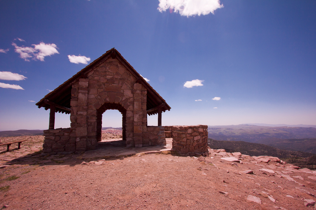
Brian Head Peak, at 11,307 feet (3,446 m) high is the highest peak on the Markagunt Plateau and in Iron County in southwestern Utah.[3] Brian Head Peak is located east of Cedar City and just north of Cedar Breaks National Monument in Dixie National Forest.[4] The town of Brian Head at the western base of the mountain is the location of the Brian Head Ski Resort.
There is a Forest Service lookout on the peak that was built in 1934-1935, and there is also a road to the summit that can be driven in summer.[5]
There is a Forest Service lookout on the peak that was built in 1934-1935, and there is also a road to the summit that can be driven in summer.[5]

BRYCE CANYON
Bryce Canyon National Park ( /ˈbraɪs/) is a national park located in southwestern Utah in the United States. The major feature of the park is Bryce Canyon which, despite its name, is not a canyon but a giant natural amphitheater created by erosion along the eastern side of the Paunsaugunt Plateau. Bryce is distinctive due to geological structures called hoodoos, formed by wind, water, and ice erosion of the river and lake bed sedimentary rocks. The red, orange, and white colors of the rocks provide spectacular views for park visitors. Bryce sits at a much higher elevation than nearby Zion National Park. The rim at Bryce varies from 8,000 to 9,000 feet (2,400 to 2,700 m).
The Bryce area was settled by Mormon pioneers in the 1850s and was named after Ebenezer Bryce, who homesteaded in the area in 1874.[3] The area around Bryce Canyon became a U.S. National Monument in 1923 and was designated as a national park in 1928. The park covers 35,835 acres (55.99 sq mi; 145.02 km2)[1] and receives relatively few visitors compared to Zion National Park and the Grand Canyon, largely due to its remote location. The town of Kanab, Utah, is situated at a central point between these three parks.
The Bryce area was settled by Mormon pioneers in the 1850s and was named after Ebenezer Bryce, who homesteaded in the area in 1874.[3] The area around Bryce Canyon became a U.S. National Monument in 1923 and was designated as a national park in 1928. The park covers 35,835 acres (55.99 sq mi; 145.02 km2)[1] and receives relatively few visitors compared to Zion National Park and the Grand Canyon, largely due to its remote location. The town of Kanab, Utah, is situated at a central point between these three parks.
SOLAR ECLIPSE
An annular solar eclipse took place on May 20, 2012 (May 21, 2012 in local time in the Eastern Hemisphere), with a magnitude of 0.9439. A solar eclipse occurs when the Moon passes between Earth and the Sun, thereby totally or partially obscuring the image of the Sun for a viewer on Earth. An annular solar eclipse occurs when the Moon's apparent diameter is smaller than the Sun, causing the Sun to look like an annulus (ring), blocking most of the Sun's light. An annular eclipse appears as a partial eclipse over a region thousands of kilometres wide. This is also known as Ring of Fire.[1] Wiki Link


ZION
Zion National Park is located in the Southwestern United States, near Springdale, Utah. A prominent feature of the 229-square-mile (590 km2) park is Zion Canyon, which is 15 miles (24 km) long and up to half a mile (800 m) deep, cut through the reddish and tan-colored Navajo Sandstone by the North Fork of the Virgin River. The lowest elevation is 3,666 ft (1,117 m) at Coalpits Wash and the highest elevation is 8,726 ft (2,660 m) at Horse Ranch Mountain. Located at the junction of the Colorado Plateau, Great Basin, and Mojave Desert regions, the park's unique geography and variety of life zones allow for unusual plant and animal diversity. Numerous plant species as well as 289 species of birds, 75 mammals (including 19 species of bat), and 32 reptiles inhabit the park's four life zones: desert, riparian, woodland, and coniferous forest. Zion National Park includes mountains, canyons, buttes, mesas, monoliths, rivers, slot canyons, and natural arches.
Human habitation of the area started about 8,000 years ago with small family groups of Native Americans; the semi-nomadic Basketmaker Anasazi(300 CE) stem from one of these groups. In turn, the Virgin Anasazi culture (500 CE) developed as the Basket makers settled in permanent communities.[3] A different group, the Parowan Fremont, lived in the area as well. Both groups moved away by 1300 and were replaced by the Parrusits and several other Southern Paiute subtribes. Mormons came into the area in 1858 and settled there in the early 1860s. In 1909, U.S. President William Howard Taft named the area a National Monument to protect the canyon, under the name of Mukuntuweap National Monument. In 1918, however, the acting director of the newly created National Park Service changed the park's name to Zion. According to historian Hal Rothman, "The name change played to a prevalent bias of the time. Many believed that Spanish and Indian names would deter visitors who, if they could not pronounce the name of a place, might not bother to visit it. The new name, Zion, had greater appeal to an ethnocentric audience." [4] The United States Congress established the monument as a National Park on November 19, 1919. The Kolob section was proclaimed a separate Zion National Monument in 1937, but was incorporated into the park in 1956.
The geology of the Zion and Kolob canyons area includes 9 formations that together represent 150 million years of mostly Mesozoic-aged sedimentation. At various periods in that time warm, shallow seas, streams, ponds and lakes, vast deserts, and dry near-shore environments covered the area. Uplift associated with the creation of the Colorado Plateaus lifted the region 10,000 feet (3,000 m) starting 13 million years ago.[5]
LAKE POWELL - PAGE, AZ
Lake Powell is a reservoir on the Colorado River, straddling the border between Utah and Arizona (most of it, along withRainbow Bridge, is in Utah). It is the second largest man-made reservoir in maximum water capacity in the United States behind Lake Mead, storing 24,322,000 acre feet (3.0001×10¹⁰ m3) of water when full. Current water levels, however, put Lake Powell ahead of Lake Mead in water volume and surface area. Lake Powell was created by the flooding of Glen Canyon by the controversial Glen Canyon Dam, which also led to the creation of Glen Canyon National Recreation Area, a popular summer destination. The reservoir is named for explorer John Wesley Powell, a one-armed American Civil War veteran who explored the river via three wooden boats in 1869. In 1972, Glen Canyon National Recreation Area was established. It is public land managed by the National Park Service, and available to the public for recreational purposes. It lies in parts of Garfield, Kane, and San Juan counties in southern Utah, and Coconino County in northern Arizona. The northern limits of the lake extend at least as far as the Hite Crossing Bridge. A map centered at the confluence of the Escalante River 37°17′22″N 110°52′20″W with the Colorado River gives a good view of the extent of the lake.
Lake Powell is a storage facility for the Upper Basin states of the Colorado River Compact (Colorado, Utah, Wyoming, and New Mexico). The Compact specifies that the Upper Basin states are to provide a minimum annual flow of 7,500,000 acre feet (9.3 km3) to the Lower Basin states (Arizona, Nevada, and California).
Lake Powell is a storage facility for the Upper Basin states of the Colorado River Compact (Colorado, Utah, Wyoming, and New Mexico). The Compact specifies that the Upper Basin states are to provide a minimum annual flow of 7,500,000 acre feet (9.3 km3) to the Lower Basin states (Arizona, Nevada, and California).
GLEN CANYON
Glen Canyon National Recreation Area (shortened to Glen Canyon NRA or GCNRA) is a recreation and conservation unit of the National Park Service (USA) that encompasses the area around Lake Powell and lower Cataract Canyon in Utah and Arizona, covering 1,254,429 acres (5,076 km2) of mostly desert. The recreation area borders Capitol Reef National Park and Canyonlands National Park on the north, Grand Staircase-Escalante National Monument on the west, Vermilion Cliffs National Monument and the north easternmost reaches of Grand Canyon National Park on the southwest, and the Navajo Indian Reservation on the southeast.
The Glen Canyon NRA was established in 1972 "to provide for public use and enjoyment and to preserve the area's scientific, historic, and scenic features."
The stated purpose of Glen Canyon NRA is for recreation as well as preservation (whereas a national park may carry more emphasis on natural preservation). As such, the area has been developed for access to Lake Powell via 5 marinas, 4 camping grounds, two small airports, and houseboat rental concessions.
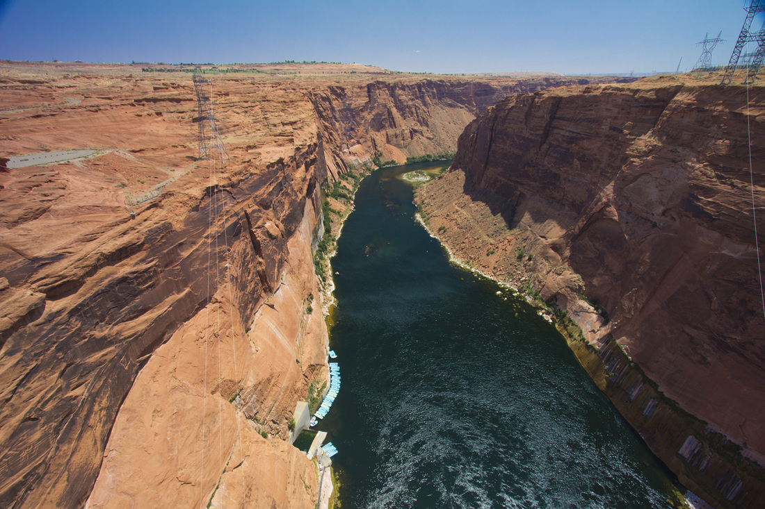
The current Lake Powell lies above Glen Canyon, which was flooded by the Glen Canyon Dam, completed in 1966.
The Glen Canyon NRA was established in 1972 "to provide for public use and enjoyment and to preserve the area's scientific, historic, and scenic features."
The stated purpose of Glen Canyon NRA is for recreation as well as preservation (whereas a national park may carry more emphasis on natural preservation). As such, the area has been developed for access to Lake Powell via 5 marinas, 4 camping grounds, two small airports, and houseboat rental concessions.
The current Lake Powell lies above Glen Canyon, which was flooded by the Glen Canyon Dam, completed in 1966.
HORSESHOE BEND
Horseshoe Bend is the name for a horseshoe-shaped meander of the Colorado River located near the town of Page, Arizona, in the United States. The bend is locally known as "King Bend." It is located five miles (8.7 km) downstream from the Glen Canyon Dam and Lake Powell within Glen Canyon National Recreation Area, about four miles or 6 km southwest of Page. Accessible via a ½-mile (0.8 km) hike from U.S. Route 89, it can be viewed from the steep cliff above. According to Google terrain maps, the overlook is 4,200 feet above sea level and the Colorado River is at 3,200 feet above sea level making it a breathtaking 1,000 foot drop.
ANTELOPE CANYON
Antelope Canyon is the most-visited and most-photographed slot canyon in the American Southwest.[1] It is located on Navajo land near Page, Arizona. Antelope Canyon includes two separate, photogenic slot canyon sections, referred to individually as Upper Antelope Canyon or The Crack; and Lower Antelope Canyon or The Corkscrew.[2]
The Navajo name for Upper Antelope Canyon is Tsé bighánílíní, which means "the place where water runs through rocks." Lower Antelope Canyon is Hazdistazí(advertised as "Hasdestwazi" by the Navajo Parks and Recreation Department), or "spiral rock arches." Both are located within the LeChee Chapter of the Navajo Nation.[3]
The Navajo name for Upper Antelope Canyon is Tsé bighánílíní, which means "the place where water runs through rocks." Lower Antelope Canyon is Hazdistazí(advertised as "Hasdestwazi" by the Navajo Parks and Recreation Department), or "spiral rock arches." Both are located within the LeChee Chapter of the Navajo Nation.[3]
RAINBOW BRIDGE
Rainbow Bridge National Monument is administered by Glen Canyon National Recreation Area, southern Utah, USA. Rainbow Bridge is often described as the world's highest natural bridge. The span of Rainbow Bridge was reported in 1974 by the Bureau of Reclamation to be 275 feet (84 m), but a laser measurement in 2007 has resulted in a span of 234 feet (71 m).[citation needed] At the top it is 42 feet (13 m) thick and 33 feet (10 m) wide.
Size
Two other natural arches, Kolob Arch and Landscape Arch, both also in southern Utah, have confirmed spans several meters longer than Rainbow Bridge, but by most definitions of the terms they are considered to be arches rather than bridges. With a height of 290 feet (88 m) Rainbow Bridge does indeed stand taller than either of its longer competitors, but it is outdone by Aloba Arch in Chad at 394 feet (120 m), which is in turn dwarfed by the world's tallest arch, Tushuk Tash in China at an estimated 1,200 feet (370 m). Finally, Xianren Bridge (also known as Fairy Bridge), in Guangxi Province, China, with a span of about 295 feet (90 m), and a height of the opening of 210 feet (64 m), appears to be the largest natural bridge in the world.
Access
Rainbow Bridge is one of the most accessible of the large arches of the world, as it can be reached by a two-hour boat ride on Lake Powell from either of two marinas near Page, Arizona, followed by a short mile-long walk from the National Park wharf in Bridge Canyon or by hiking several hours overland from a trailhead on the south side of Lake Powell (obtain a permit from the Navajo Nation in Window Rock, Arizona).[3]
Geology
The Rainbow Bridge and surrounding canyon seen from the Navajo Mountain side Rainbow Bridge is made from sandstone formed during the end of the Triassic and the Jurassic periods. Extreme fluctuations in climate during the Triassic and Jurassic periods—the region was alternately a sea and desert on par with the Sahara—produced layers of sandstone with different levels of hardness. By the end of the Jurassic, the sea returned to cover these layers of sandstone and compressed them so tightly that they would persist until the present day.
As Bridge Creek flowed toward the growing Colorado River during the last ice age, it carved first through softer rocks and veered away from the harder Triassic and Jurassic sandstones, eventually creating a wide hairpin bend that flowed around a solid "fin" of sandstone that would become Rainbow Bridge. The previous course of the creek is still visible above the bridge. Water flows back on itself at bends and wide spots, creating swirling eddies along the banks. As the creek flowed around Rainbow Bridge fin, these abrasive eddies formed on both the upstream and downstream sides and cut circular alcoves in the rock wall. The sediment in the creek eventually scoured the softer layers of sandstone away, leaving the harder layers behind.
GRAND CANYON
The Grand Canyon (Hopi: Ongtupqa; Yavapai: Wi:kaʼi:la) is a steep-sided canyon carved by the Colorado River in the United States in the state of Arizona. It is contained within and managed by Grand Canyon National Park, the Hualapai Tribal Nation, and the Havasupai Tribe. President Theodore Roosevelt was a major proponent of preservation of the Grand Canyon area, and visited it on numerous occasions to hunt and enjoy the scenery. It is considered one of theSeven Natural Wonders of the World.[1]
The Grand Canyon is 277 miles (446 km) long, up to 18 miles (29 km) wide and attains a depth of over a mile (6,000 feet / 1,800 metres)[2] Nearly two billion years of the Earth's geological history have been exposed as the Colorado River and its tributaries cut their channels through layer after layer of rock while theColorado Plateau was uplifted.[3] While the specific geologic processes and timing that formed the Grand Canyon are the subject of debate by geologists,[4]recent evidence suggests the Colorado River established its course through the canyon at least 17 million years ago.[5][6] Since that time, the Colorado River continued to erode and form the canyon to its present-day configuration.[7]
For thousands of years, the area has been continuously inhabited by Native Americans who built settlements within the canyon and its many caves. ThePueblo people considered the Grand Canyon ("Ongtupqa" in Hopi language) a holy site and made pilgrimages to it.[8] The first European known to have viewed the Grand Canyon was García López de Cárdenas from Spain, who arrived in 1540.[9]
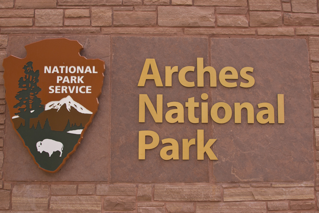
ARCHES
Arches National Park is a U.S. National Park in eastern Utah. It is known for preserving over 2000 natural sandstone arches, including the world-famous Delicate Arch, in addition to a variety of unique geological resources and formations.
The park is located just outside of Moab, Utah, and is 76,679 acres (31,031 ha) in area. Its highest elevation is 5,653 feet (1,723 m) at Elephant Butte, and its lowest elevation is 4,085 feet (1,245 m) at the visitor center. Forty-three arches have collapsed due to erosion since 1970. The park receives 10 inches (250 mm) of rain a year on average.
Administered by the National Park Service, the area was originally created as a National Monument on April 12, 1929. It was redesignated as a National Park on November 12, 1971.[3]
CANYONLAND
Canyonlands National Park is a U.S. National Park located in southeastern Utah near the town of Moab and preserves a colorful landscape eroded into countless canyons, mesas and buttes by the Colorado River, the Green River, and their respective tributaries. The park is divided into four districts: the Island in the Sky, the Needles, the Maze, and the rivers themselves. While these areas share a primitive desert atmosphere, each retains its own character. Two large river canyons are carved into the Colorado Plateau by the Colorado River and Green River.[3] Author Edward Abbey, a frequent visitor, described the Canyonlands as "the most weird, wonderful, magical place on earth—there is nothing else like it anywhere."[4]
TIMPANOGOS CAVES
Timpanogos Cave National Monument is a cave system in the Wasatch Mountains in American Fork Canyon near American Fork, Utah, in the United States. The 1.5 mile trail to the cave is steep at several points, but paved and wide, so the cave opening is accessible to most. Tours are run when the monument is open, usually from May through October depending on snow conditions.
There are three main chambers accessible in the tour: Hansen Cave, Middle Cave, and Timpanogos Cave. Many colorful cave features or speleothems can be seen. Among the most interesting are the helictites, which are like hollowed straws of rock. They are thought to be formed when water travels through the tube and then evaporates, leaving a small mineral deposit at the end. Other speleothems found in the cave include: cave bacon, cave columns,flowstone, cave popcorn, cave drapery, helictites, stalactites and stalagmites.
Martin Hansen discovered Hansen Cave in October 1887, reportedly while tracking a cougar high up the side of American Fork Canyon. Unfortunately, many of the features and formations in this chamber were damaged or removed before the cave was made a national monument.
The man credited with discovering Timpanogos Cave was named Vearl J. Manwill. He came with the Payson Outdoors Club in 1921. After doing the tour of Hansen's Cave, they went different ways to try to find the rumored cave. Vearl went up above Hansen's, alone. After a little way, he found a crack, and looked in. He called the rest of the club to come look at what he had found.
That fall, George Heber Hansen and Wayne E. Hansen, Martin Hansen's son and grandson, were hunting on the other side of the canyon. While using binoculars to try to find deer, they came across another hole in the mountain, in between the other two caves. In a few days they came back, with 74 year-old Martin Hansen. Martin was the first human being in the cave, now called Middle Cave.
Middle Cave and Timpanogos Cave were discovered in an era where their formations and resources could be protected. The National Park Service, which oversees and preserves the cave complex, has continued to develop new ways to retain its natural features, including limiting lighting in the caves to retard growth of invasive organisms.

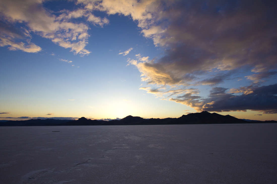
BONNEVILLE SALT FLATS
The Bonneville Salt Flats is a densely-packed salt pan in Tooele County in northwestern Utah. The area is a remnant of the Pleistocene Lake Bonnevilleand is the largest of many salt flats located west of the Great Salt Lake. The property is public land managed by the Bureau of Land Management and is known for land speed records at the "Bonneville Speedway". Access is free and visitors can drive on the flats.
History
Geologist Grove Karl Gilbert named the area after Benjamin Bonneville, a U.S. Army officer who explored the Intermountain West in the 1830s.[3][4] In 1907 Bill Rishel and two local businessmen tested the suitability of the salt for driving on by taking a Pierce-Arrow onto the surface of the flats.[5] A railway line across the Bonneville Salt Flats was completed in 1910, marking the first permanent crossing.[3] The first land speed record was set there in 1914 by Teddy Tetzlaff.[6]
Entertainment filmed at the salt flats include portions of Knight Rider TV Series (1982), Warlock,Independence Day, SLC Punk, Cremaster 2 from Cremaster Cycle, The Brown Bunny, The World's Fastest Indian, Gerry, The Tree of Life and Pirates of the Caribbean: At World's End. Furthermore, the Pontiac Bonneville (former flagship sedan of the Pontiac motor division), the Triumph Bonneville motorcycle, and the Bonneville International media company are all named for the salt flats.
Reduction In Size
Due to extraction of salt from the area, the salt flats have begun to disappear. Once around 90,000 acres in size, they are now only 30,000 acres.[7] The salt layer is thought to be shrinking due to the use of the salt in the making of potash, a mineral ingredient used in fertilizer. A nearby potash plant uses a system of canals, pipes, and tunnels to collect the brine that is produced during the rainy winter season in the area. This brine is then used to make potash. The company has begun to voluntarily spray leftover brine back onto the salt flats. It is estimated that over 55 million short tons of salt have been taken from the salt flats since mining began in 1963. Geologists estimate that 18 inches of salt crust have been removed from the flats, and that the reduction of salt happens at a pace of one percent per year. In some areas, the salt is now a mere 1/2 inch thick.

